Avanos night lights from space
Night Light of Avanos (Nevşehir) from space (Turkey) Src. Average luminocity for 10x10km area is 20.5034% and for 50x50km: 9.8927%.
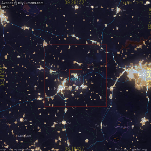
Analysis of Avanos night lights 2016
Square area 10x10 km:
 2.04%
2.04%90-99
4.42%80-89
3.57%70-79
2.04%60-69
0.17%50-59
1.7%40-49
1.36%30-39
0.34%20-29
0.68%10-19
41.5%0-9
42.18%Square area 50x50 km:
0.69%90-99
1.74%80-89
1.14%70-79
1.33%60-69
0.91%50-59
0.98%40-49
1.31%30-39
1.48%20-29
2.07%10-19
9.26%0-9
79.09%Clear (daylight) street map image can be seen on geolist.org.
Map coordinates:
39° 15' 41.5" North, 34° 8' 36.8" East
38° 42' 54" North, 34° 50' 48" East
38° 9' 51.4" North, 35° 32' 59.3" East
Some cities around Avanos sort by population:
• Nevşehir
15.4 km =9.6 mi,  229°
229°
• Ürgüp
11.1 km =6.9 mi,  149°
149°
• Yeşilhisar
45.5 km =28.3 mi, 152°
• Derinkuyu
39 km =24.2 mi,  194°
194°
• Gülşehir
19.5 km =12.1 mi,  280°
280°
• Hacıbektaş
35.5 km =22.1 mi,  315°
315°
• Acıgöl
34.6 km =21.5 mi,  238°
238°
• Göreme
8 km =5 mi, 187°
322965 (p: 12,833)
Sources (retrieved 2019-11-25):
» Earth at Night: Flat Maps 2012, 2016