Philipsburg night lights from space
Night Light of Philipsburg from space (Sint Maarten) Src. Average luminocity for 10x10km area is 44.7165% and for 50x50km: 6.0404%.
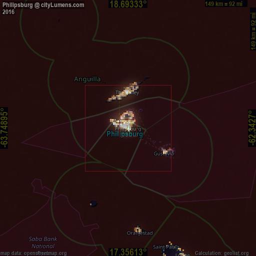
Analysis of Philipsburg night lights 2016
Square area 10x10 km:
 8.87%
8.87%90-99
7.36%80-89
9.74%70-79
8.44%60-69
6.71%50-59
2.81%40-49
1.3%30-39
1.95%20-29
8.23%10-19
27.92%0-9
16.67%Square area 50x50 km:
0.56%90-99
0.61%80-89
0.94%70-79
1.08%60-69
1.56%50-59
0.43%40-49
0.39%30-39
0.7%20-29
1.1%10-19
5.67%0-9
86.97%Clear (daylight) street map image can be seen on geolist.org.
Map coordinates:
18° 41' 36" North, 63° 44' 56.2" West
18° 1' 33.6" North, 63° 2' 45" West
17° 21' 22.1" North, 62° 20' 33.7" West
Some cities around Philipsburg sort by population:
• Cul de Sac
3.2 km =2 mi,  320°
320°
• Lower Prince’s Quarter
2.8 km =1.7 mi,  17°
17°
• Koolbaai
4.3 km =2.7 mi,  291°
291°
• Marigot, MF
6.1 km =3.8 mi, 320°
• Blowing Point Village, AI
17.5 km =10.9 mi,  343°
343°
• West End Village, AI
19.6 km =12.2 mi,  325°
325°
• George Hill, AI
19.4 km =12.1 mi,  353°
353°
• South Hill Village, AI
19 km =11.8 mi, 346°
3513392 (p: 1,400)
Sources (retrieved 2019-11-25):
» Earth at Night: Flat Maps 2012, 2016