Lower Prince’s Quarter night lights from space
Night Light of Lower Prince’s Quarter from space (Sint Maarten) Src. Average luminocity for 10x10km area is 52.8247% and for 50x50km: 6.2688%.
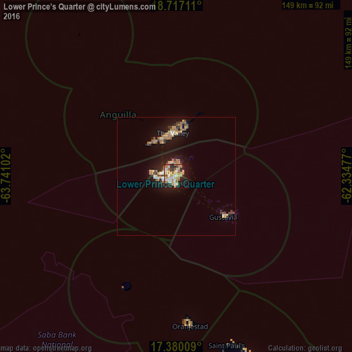
Analysis of Lower Prince’s Quarter night lights 2016
Square area 10x10 km:
 8.44%
8.44%90-99
9.09%80-89
11.04%70-79
11.47%60-69
9.96%50-59
3.68%40-49
3.68%30-39
4.33%20-29
10.39%10-19
24.24%0-9
3.68%Square area 50x50 km:
0.56%90-99
0.61%80-89
0.94%70-79
1.11%60-69
1.62%50-59
0.46%40-49
0.42%30-39
0.78%20-29
1.11%10-19
5.94%0-9
86.44%Clear (daylight) street map image can be seen on geolist.org.
Map coordinates:
18° 43' 1.6" North, 63° 44' 27.7" West
18° 2' 59.5" North, 63° 2' 16.4" West
17° 22' 48.3" North, 62° 20' 5.2" West
Some cities around Lower Prince’s Quarter sort by population:
• Cul de Sac
2.9 km =1.8 mi,  267°
267°
• Koolbaai
5 km =3.1 mi,  257°
257°
• Marigot, MF
5.2 km =3.2 mi,  293°
293°
• Philipsburg
2.8 km =1.7 mi,  197°
197°
• Blowing Point Village, AI
15.3 km =9.5 mi,  337°
337°
• The Quarter, AI
17.6 km =10.9 mi,  358°
358°
• George Hill, AI
16.9 km =10.5 mi,  349°
349°
• South Hill Village, AI
16.7 km =10.4 mi, 341°
3513522 (p: 8,000)
Sources (retrieved 2019-11-25):
» Earth at Night: Flat Maps 2012, 2016