West End Village night lights from space
Night Light of West End Village (West End) from space (Anguilla) Src. Average luminocity for 10x10km area is 9.2706% and for 50x50km: 5.8872%.
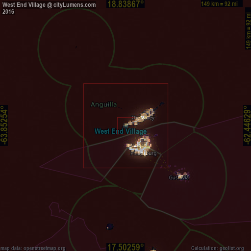
Analysis of West End Village night lights 2016
Square area 10x10 km:
 0%
0%90-99
0%80-89
0%70-79
2.16%60-69
3.68%50-59
1.52%40-49
2.16%30-39
1.3%20-29
0.43%10-19
6.49%0-9
82.25%Square area 50x50 km:
0.53%90-99
0.58%80-89
0.85%70-79
1.05%60-69
1.59%50-59
0.42%40-49
0.32%30-39
0.65%20-29
1.02%10-19
5.77%0-9
87.22%Clear (daylight) street map image can be seen on geolist.org.
Map coordinates:
18° 50' 19.2" North, 63° 51' 9.1" West
18° 10' 18.9" North, 63° 8' 57.9" West
17° 30' 9.3" North, 62° 26' 46.6" West
Some cities around West End Village sort by population:
• The Valley
10.9 km =6.8 mi,  62°
62°
• Blowing Point Village
5.9 km =3.7 mi,  85°
85°
• Sandy Ground Village
7.1 km =4.4 mi, 62°
• Stoney Ground
12.2 km =7.6 mi, 63°
• The Quarter
12.1 km =7.5 mi,  70°
70°
• George Hill
9.3 km =5.8 mi, 70°
• North Hill Village
8.4 km =5.2 mi, 63°
• South Hill Village
6.9 km =4.3 mi, 71°
3573364 (p: 0)
Sources (retrieved 2019-11-25):
» Earth at Night: Flat Maps 2012, 2016