Hastings night lights from space
Night Light of Hastings (Western Area) from space (Sierra Leone) Src. Average luminocity for 10x10km area is 2.8017% and for 50x50km: 2.4962%.
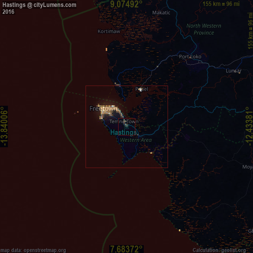
Analysis of Hastings night lights 2016
Square area 10x10 km:
 0%
0%90-99
0%80-89
0%70-79
0%60-69
0%50-59
0%40-49
1.86%30-39
1.03%20-29
4.13%10-19
0.41%0-9
92.56%Square area 50x50 km:
0.06%90-99
0.04%80-89
0.23%70-79
0.38%60-69
0.84%50-59
0.55%40-49
0.48%30-39
0.46%20-29
0.4%10-19
2.21%0-9
94.35%Clear (daylight) street map image can be seen on geolist.org.
Map coordinates:
9° 4' 29.7" North, 13° 50' 24.2" West
8° 22' 47.8" North, 13° 8' 12.9" West
7° 41' 1.4" North, 12° 26' 1.7" West
Some cities around Hastings sort by population:
• Freetown
16.1 km =10 mi,  317°
317°
• Lunsar
74.3 km =46.2 mi,  62°
62°
• Port Loko
57.7 km =35.9 mi,  41°
41°
• Waterloo
8.6 km =5.3 mi,  122°
122°
• Freetown
17.8 km =11.1 mi,  288°
288°
• Mambolo
60.9 km =37.8 mi,  10°
10°
• Tintafor
28.7 km =17.8 mi,  342°
342°
• Kassiri
62.1 km =38.6 mi,  2°
2°
2408582 (p: 5,121)
Sources (retrieved 2019-11-25):
» Earth at Night: Flat Maps 2012, 2016