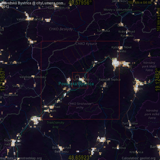
Považská Bystrica night lights from space
Night Light of Považská Bystrica (Trenčiansky kraj) from space (Slovakia) Src. Average luminocity for 10x10km area is 12.8473% and for 50x50km: 3.6943%.
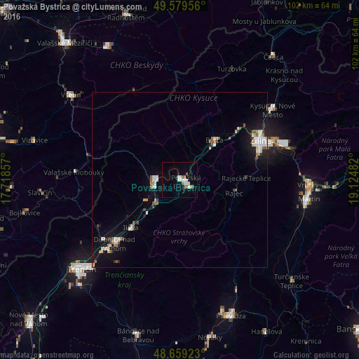
Analysis of Považská Bystrica night lights 2016
Square area 10x10 km:
 3.08%
3.08%90-99
3.08%80-89
0.56%70-79
0.14%60-69
0.98%50-59
2.24%40-49
0.28%30-39
0.28%20-29
0.28%10-19
2.8%0-9
86.27%Square area 50x50 km:
0.75%90-99
0.66%80-89
0.29%70-79
0.24%60-69
0.33%50-59
0.51%40-49
0.3%30-39
0.25%20-29
0.47%10-19
2.58%0-9
93.62%Clear (daylight) street map image can be seen on geolist.org.
Map coordinates:
49° 34' 46.4" North, 17° 43' 6.9" East
49° 7' 17.5" North, 18° 25' 18.1" East
48° 39' 33.2" North, 19° 7' 29.4" East
Some cities around Považská Bystrica sort by population:
• Žilina
25.7 km =16 mi,  63°
63°
• Dubnica nad Váhom
25.9 km =16.1 mi,  225°
225°
• Púchov
7 km =4.3 mi,  273°
273°
• Nová Dubnica
28.9 km =18 mi,  224°
224°
• Bytča
15.1 km =9.4 mi,  41°
41°
• Rajec
16.3 km =10.1 mi,  102°
102°
• Nemšová
28 km =17.4 mi, 232°
• Ilava
19.3 km =12 mi, 224°
3058060 (p: 43,936)
Sources (retrieved 2019-11-25):
» Earth at Night: Flat Maps 2012, 2016