Rajec night lights from space
Night Light of Rajec (Žilinský kraj) from space (Slovakia) Src. Average luminocity for 10x10km area is 0.93% and for 50x50km: 4.5879%.
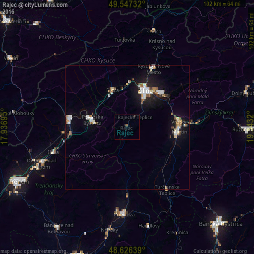
Analysis of Rajec night lights 2016
Square area 10x10 km:
 0%
0%90-99
0%80-89
0%70-79
0%60-69
0%50-59
0.56%40-49
0.14%30-39
0.98%20-29
0%10-19
0.84%0-9
97.48%Square area 50x50 km:
0.88%90-99
0.86%80-89
0.34%70-79
0.26%60-69
0.56%50-59
0.58%40-49
0.34%30-39
0.35%20-29
0.75%10-19
3.88%0-9
91.2%Clear (daylight) street map image can be seen on geolist.org.
Map coordinates:
49° 32' 50.4" North, 17° 56' 13" East
49° 5' 20.4" North, 18° 38' 24.3" East
48° 37' 35" North, 19° 20' 35.5" East
Some cities around Rajec sort by population:
• Žilina
16.6 km =10.3 mi,  25°
25°
• Martin
20.8 km =12.9 mi,  96°
96°
• Považská Bystrica
16.3 km =10.1 mi,  282°
282°
• Púchov
23.2 km =14.4 mi, 279°
• Kysucké Nové Mesto
25.7 km =16 mi,  23°
23°
• Bytča
16.1 km =10 mi,  338°
338°
• Vrútky
20.4 km =12.7 mi,  82°
82°
• Ilava
31.2 km =19.4 mi,  251°
251°
3057910 (p: 6,400)
Sources (retrieved 2019-11-25):
» Earth at Night: Flat Maps 2012, 2016