Sv. Trojica v Slov. Goricah night lights from space
Night Light of Sv. Trojica v Slov. Goricah from space (Slovenia) Src. Average luminocity for 10x10km area is 6.5071% and for 50x50km: 7.1607%.
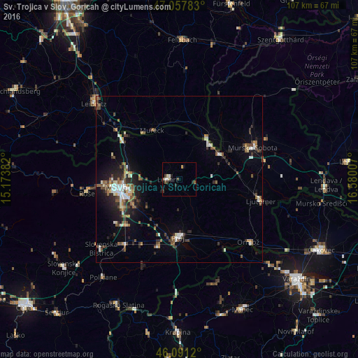
Analysis of Sv. Trojica v Slov. Goricah night lights 2016
Square area 10x10 km:
 1.28%
1.28%90-99
0.43%80-89
1.42%70-79
0.28%60-69
0%50-59
1.28%40-49
1.56%30-39
1.28%20-29
1.56%10-19
0.43%0-9
90.48%Square area 50x50 km:
0.84%90-99
1.2%80-89
0.49%70-79
0.53%60-69
0.89%50-59
1.27%40-49
1.28%30-39
1.15%20-29
2.06%10-19
3.49%0-9
86.8%Clear (daylight) street map image can be seen on geolist.org.
Map coordinates:
47° 3' 28.2" North, 15° 10' 25.8" East
46° 34' 36" North, 15° 52' 37" East
46° 5' 28.3" North, 16° 34' 48.3" East
Some cities around Sv. Trojica v Slov. Goricah sort by population:
• Lenart v Slov. Goricah
3.5 km =2.2 mi,  268°
268°
• Benedikt
3.7 km =2.3 mi,  13°
13°
• Jurovski Dol
7.8 km =4.8 mi,  295°
295°
• Trnovska Vas
6.3 km =3.9 mi,  173°
173°
• Vitomarci
7.3 km =4.5 mi,  138°
138°
• Destrnik
9.4 km =5.8 mi,  179°
179°
• Sv. Ana v Slov. Goricah
8.4 km =5.2 mi,  342°
342°
• Cerkvenjak
5.1 km =3.2 mi,  97°
97°
3199685 (p: 730)
Sources (retrieved 2019-11-25):
» Earth at Night: Flat Maps 2012, 2016