Vellinge night lights from space
Night Light of Vellinge (Skåne) from space (Sweden) Src. Average luminocity for 10x10km area is 14.1779% and for 50x50km: 12.5631%.
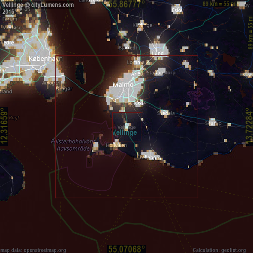
Analysis of Vellinge night lights 2016
Square area 10x10 km:
 1.38%
1.38%90-99
1.63%80-89
0.75%70-79
0.5%60-69
1%50-59
0%40-49
1.5%30-39
2.01%20-29
3.51%10-19
37.09%0-9
50.63%Square area 50x50 km:
3.89%90-99
2.68%80-89
0.76%70-79
0.66%60-69
0.82%50-59
0.66%40-49
1.01%30-39
1.74%20-29
4.14%10-19
7.02%0-9
76.62%Clear (daylight) street map image can be seen on geolist.org.
Map coordinates:
55° 52' 4" North, 12° 18' 59.7" East
55° 28' 16.5" North, 13° 1' 11" East
55° 4' 14.4" North, 13° 43' 22.2" East
Some cities around Vellinge sort by population:
• Malmö
15 km =9.3 mi,  355°
355°
• Trelleborg
13.8 km =8.6 mi,  140°
140°
• Höllviken
7.9 km =4.9 mi,  210°
210°
• Bunkeflostrand
10.2 km =6.3 mi,  323°
323°
• Oxie
9 km =5.6 mi,  32°
32°
• Svedala
14.2 km =8.8 mi,  73°
73°
• Skanör med Falsterbo
13.3 km =8.3 mi,  233°
233°
• Skåre
10 km =6.2 mi,  168°
168°
2663399 (p: 6,496)
Sources (retrieved 2019-11-25):
» Earth at Night: Flat Maps 2012, 2016