Partille night lights from space
Night Light of Partille (Västra Götaland) from space (Sweden) Src. Average luminocity for 10x10km area is 55.4023% and for 50x50km: 20.1149%.
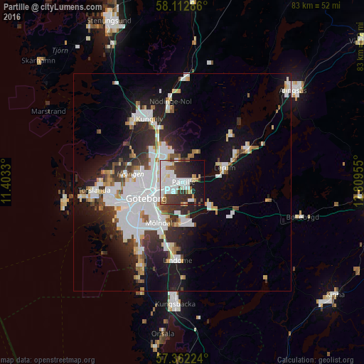
Analysis of Partille night lights 2016
Square area 10x10 km:
 19.09%
90-99
15.34%80-89
3.52%70-79
3.3%60-69
3.3%50-59
2.39%40-49
5.91%30-39
12.05%20-29
12.05%10-19
17.39%0-9
5.68%Square area 50x50 km:
6.28%90-99
4.75%80-89
1.52%70-79
1.36%60-69
1.34%50-59
1.39%40-49
1.6%30-39
2.57%20-29
4.8%10-19
11.03%0-9
63.36%Clear (daylight) street map image can be seen on geolist.org.
Map coordinates:
58° 6' 46.3" North, 11° 24' 11.9" East
57° 44' 22.2" North, 12° 6' 23.1" East
57° 21' 44.1" North, 12° 48' 34.4" East
Some cities around Partille sort by population:
• Göteborg
9 km =5.6 mi,  246°
246°
• Mölndal
10.9 km =6.8 mi,  210°
210°
• Lerum
10.2 km =6.3 mi,  70°
70°
• Mölnlycke
9 km =5.6 mi,  175°
175°
• Landvetter
8.6 km =5.3 mi,  133°
133°
• Gårdsten
8.6 km =5.3 mi,  327°
327°
• Hammarkullen
6.2 km =3.9 mi,  317°
317°
• Lövgärdet
9.4 km =5.8 mi, 334°
2684395 (p: 28,648)
Sources (retrieved 2019-11-25):
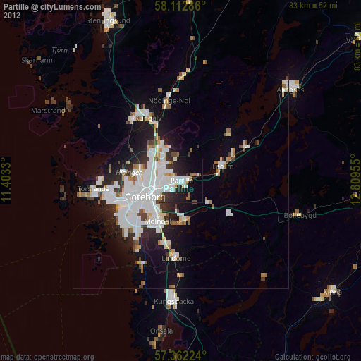
» Earth at Night: Flat Maps 2012, 2016