Arlöv night lights from space
Night Light of Arlöv (Skåne) from space (Sweden) Src. Average luminocity for 10x10km area is 65.8308% and for 50x50km: 14.1908%.
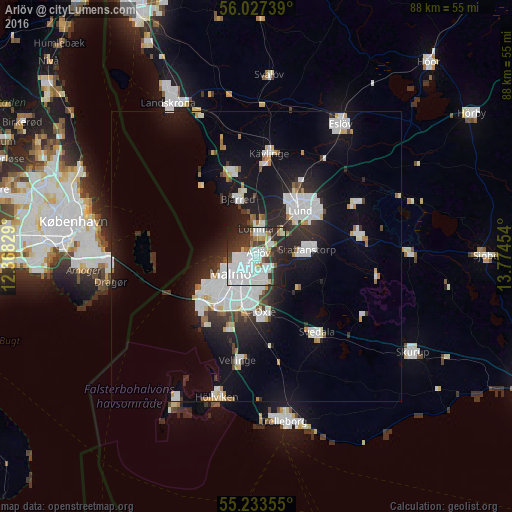
Analysis of Arlöv night lights 2016
Square area 10x10 km:
100  30.83%
90-99 16.04%
80-89 2.26%
70-79 3.01%
60-69 3.63%
50-59 3.26%
40-49 5.64%
30-39 8.77%
20-29 19.05%
10-19 7.52%
0-9 0%
30.83%90-99
16.04%80-89
2.26%70-79
3.01%60-69
3.63%50-59
3.26%40-49
5.64%30-39
8.77%20-29
19.05%10-19
7.52%0-9
0%Square area 50x50 km:
100 4.38%
90-99 3.09%
80-89 0.86%
70-79 0.71%
60-69 0.87%
50-59 0.62%
40-49 0.78%
30-39 1.67%
20-29 4.11%
10-19 10.34%
0-9 72.58%
4.38%90-99
3.09%80-89
0.86%70-79
0.71%60-69
0.87%50-59
0.62%40-49
0.78%30-39
1.67%20-29
4.11%10-19
10.34%0-9
72.58%Clear (daylight) street map image can be seen on geolist.org.
Map coordinates:
56° 1' 38.6" North, 12° 22' 5.8" East
55° 37' 56.9" North, 13° 4' 17.1" East
55° 14' 0.8" North, 13° 46' 28.3" East
Some cities around Arlöv sort by population:
• Malmö
5.3 km =3.3 mi,  236°
236°
• Lund
11.2 km =7 mi,  43°
43°
• Staffanstorp
8.5 km =5.3 mi,  82°
82°
• Bunkeflostrand
13.5 km =8.4 mi,  223°
223°
• Oxie
10.4 km =6.5 mi,  171°
171°
• Lomma
4.4 km =2.7 mi,  357°
357°
• Bjärred
10 km =6.2 mi,  339°
339°
• Åkarp
3.4 km =2.1 mi,  46°
46°
2725336 (p: 9,108)
Sources (retrieved 2019-11-25):
» Earth at Night: Flat Maps 2012, 2016