Lund night lights from space
Night Light of Lund (Skåne) from space (Sweden) Src. Average luminocity for 10x10km area is 47.7057% and for 50x50km: 14.8838%.
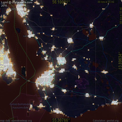
Analysis of Lund night lights 2016
Square area 10x10 km:
 15.31%
90-99
13.76%80-89
2.87%70-79
0.84%60-69
2.15%50-59
1.44%40-49
1.67%30-39
6.82%20-29
29.43%10-19
23.56%0-9
2.15%Square area 50x50 km:
4.73%90-99
3.35%80-89
0.89%70-79
0.71%60-69
0.93%50-59
0.73%40-49
0.84%30-39
1.73%20-29
3.96%10-19
10.34%0-9
71.8%Clear (daylight) street map image can be seen on geolist.org.
Map coordinates:
56° 6' 0" North, 12° 29' 24.3" East
55° 42' 21" North, 13° 11' 35.6" East
55° 18' 27.6" North, 13° 53' 46.8" East
Some cities around Lund sort by population:
• Staffanstorp
7.1 km =4.4 mi,  173°
173°
• Lomma
8.7 km =5.4 mi,  244°
244°
• Bjärred
11.1 km =6.9 mi,  276°
276°
• Kävlinge
10.9 km =6.8 mi,  331°
331°
• Arlöv
11.2 km =7 mi,  223°
223°
• Södra Sandby
9.7 km =6 mi,  82°
82°
• Dalby
10.7 km =6.6 mi,  113°
113°
• Åkarp
7.7 km =4.8 mi, 221°
2693678 (p: 87,244)
Sources (retrieved 2019-11-25):
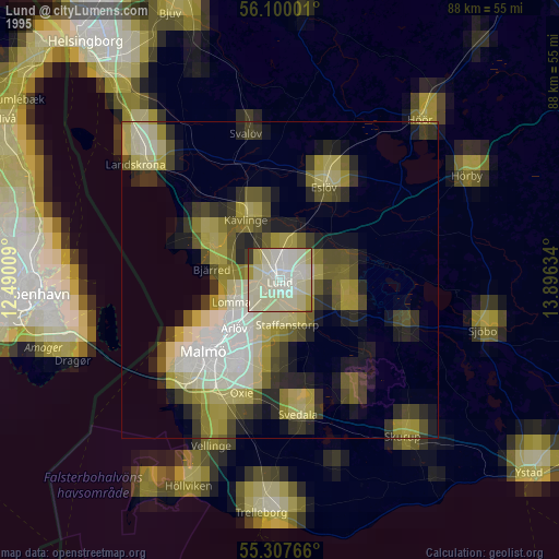
» NASA, Earths city lights 1995
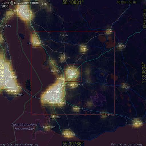
» NASA city lights 2003
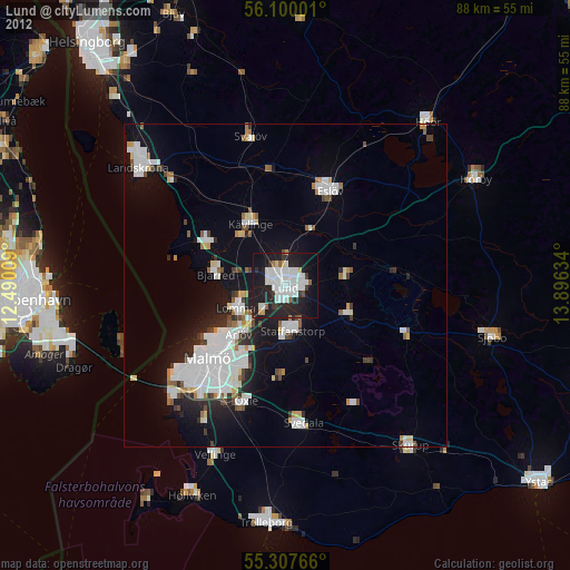
» Earth at Night: Flat Maps 2012, 2016