Zheleznodorozhnyy night lights from space
Night Light of Zheleznodorozhnyy (Moscow Oblast) from space (Russia) Src. Average luminocity for 10x10km area is 72.5% and for 50x50km: 55.4315%.
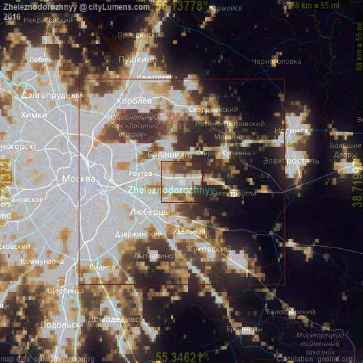
Analysis of Zheleznodorozhnyy night lights 2016
Square area 10x10 km:
 19.86%
90-99
21.17%80-89
6.94%70-79
11.12%60-69
7.06%50-59
8.01%40-49
10.05%30-39
6.94%20-29
8.85%10-19
0%0-9
0%Square area 50x50 km:
21.8%90-99
11.88%80-89
4.33%70-79
4.93%60-69
5.28%50-59
4.42%40-49
5.3%30-39
7.47%20-29
9.79%10-19
8.14%0-9
16.67%Clear (daylight) street map image can be seen on geolist.org.
Map coordinates:
56° 8' 16" North, 37° 18' 49.4" East
55° 44' 38.4" North, 38° 1' 0.6" East
55° 20' 46.4" North, 38° 43' 11.9" East
Some cities around Zheleznodorozhnyy sort by population:
• Balashikha
8.2 km =5.1 mi,  333°
333°
• Reutov
10.2 km =6.3 mi,  280°
280°
• Zarya
5.1 km =3.2 mi,  75°
75°
• Malakhovka
10.7 km =6.6 mi,  177°
177°
• Kraskovo
10.6 km =6.6 mi,  189°
189°
• Kupavna
7.2 km =4.5 mi,  88°
88°
• Nekrasovka
8.7 km =5.4 mi,  229°
229°
• Korenëvo
8 km =5 mi, 184°
463355 (p: 141,648)
Sources (retrieved 2019-11-25):
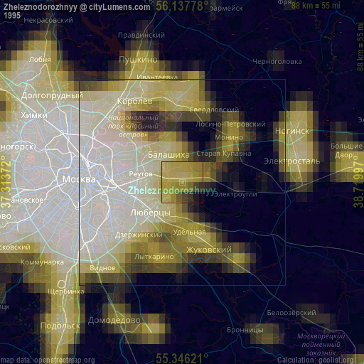
» NASA, Earths city lights 1995
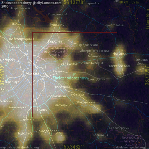
» NASA city lights 2003
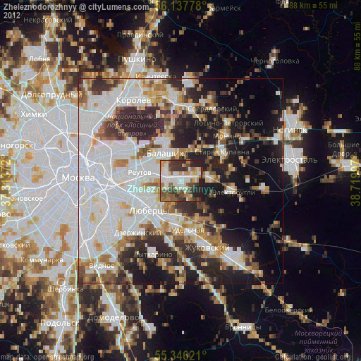
» Earth at Night: Flat Maps 2012, 2016