Balashikha night lights from space
Night Light of Balashikha (Moscow Oblast) from space (Russia) Src. Average luminocity for 10x10km area is 67.4187% and for 50x50km: 56.9354%.
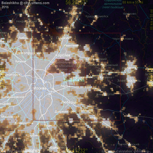
Analysis of Balashikha night lights 2016
Square area 10x10 km:
 18.3%
18.3%90-99
17.11%80-89
7.42%70-79
6.1%60-69
5.98%50-59
9.45%40-49
11.48%30-39
15.79%20-29
8.37%10-19
0%0-9
0%Square area 50x50 km:
25.47%90-99
11.96%80-89
4.07%70-79
4.45%60-69
4.52%50-59
3.95%40-49
4.53%30-39
6.93%20-29
8.49%10-19
7.97%0-9
17.66%Clear (daylight) street map image can be seen on geolist.org.
Map coordinates:
56° 12' 9.3" North, 37° 15' 17.8" East
55° 48' 34" North, 37° 57' 29" East
55° 24' 44.4" North, 38° 39' 40.3" East
Some cities around Balashikha sort by population:
• Gol’yanovo
9.2 km =5.7 mi,  279°
279°
• Zheleznodorozhnyy
8.2 km =5.1 mi,  153°
153°
• Ivanovskoye
9.1 km =5.7 mi,  238°
238°
• Izmaylovo
10.1 km =6.3 mi,  255°
255°
• Novogireyevo
10.7 km =6.6 mi,  234°
234°
• Reutov
8.3 km =5.2 mi, 229°
• Zarya
10.5 km =6.5 mi,  124°
124°
• Vostochnyy
5.8 km =3.6 mi, 278°
579464 (p: 150,103)
Sources (retrieved 2019-11-25):
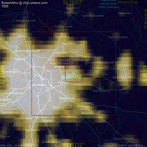
» NASA, Earths city lights 1995
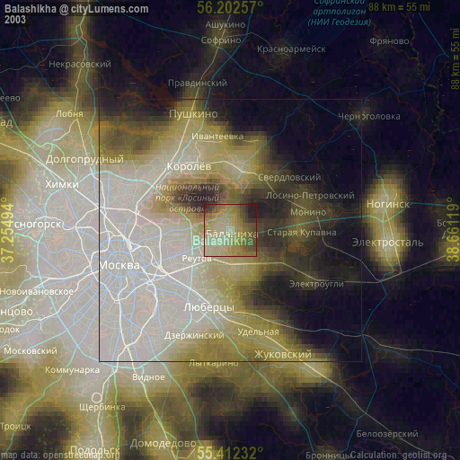
» NASA city lights 2003
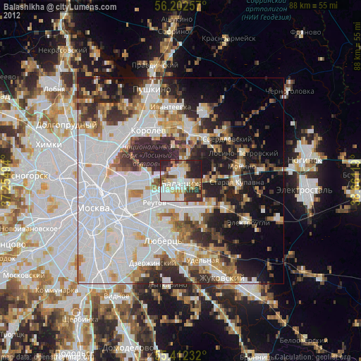
» Earth at Night: Flat Maps 2012, 2016