Zelenograd night lights from space
Night Light of Zelenograd (Moscow) from space (Russia) Src. Average luminocity for 10x10km area is 74.0013% and for 50x50km: 43.3692%.
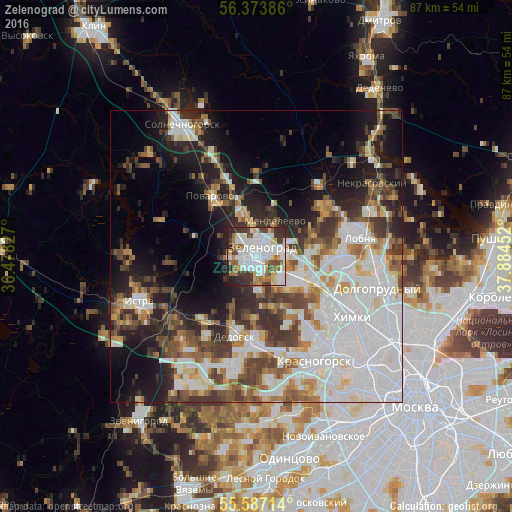
Analysis of Zelenograd night lights 2016
Square area 10x10 km:
 24.81%
90-99
23.56%80-89
5.51%70-79
5.51%60-69
9.02%50-59
5.39%40-49
6.77%30-39
10.53%20-29
7.89%10-19
1%0-9
0%Square area 50x50 km:
14.6%90-99
9.43%80-89
3.23%70-79
3.26%60-69
4.71%50-59
4.71%40-49
5.48%30-39
6.04%20-29
7.59%10-19
12.37%0-9
28.59%Clear (daylight) street map image can be seen on geolist.org.
Map coordinates:
56° 22' 25.9" North, 36° 28' 41.8" East
55° 58' 57" North, 37° 10' 53" East
55° 35' 13.7" North, 37° 53' 4.3" East
Some cities around Zelenograd sort by population:
• Nakhabino
14.9 km =9.3 mi,  180°
180°
• Dedovsk
13.2 km =8.2 mi,  196°
196°
• Skhodnya
8.2 km =5.1 mi,  117°
117°
• Novopodrezkovo
11.2 km =7 mi, 115°
• Andreyevka
2.9 km =1.8 mi,  265°
265°
• Mendeleyevo
6.1 km =3.8 mi,  21°
21°
• Povarovo
12.4 km =7.7 mi,  318°
318°
• Opalikha
18 km =11.2 mi,  165°
165°
463829 (p: 215,727)
Sources (retrieved 2019-11-25):
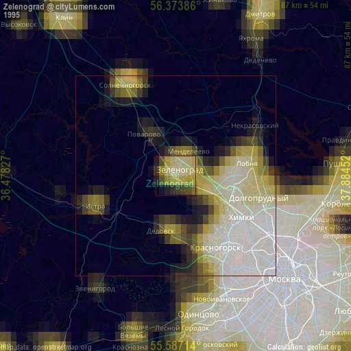
» NASA, Earths city lights 1995
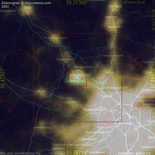
» NASA city lights 2003
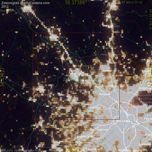
» Earth at Night: Flat Maps 2012, 2016