Yasenevo night lights from space
Night Light of Yasenevo (Moscow) from space (Russia) Src. Average luminocity for 10x10km area is 94.5226% and for 50x50km: 76.7077%.
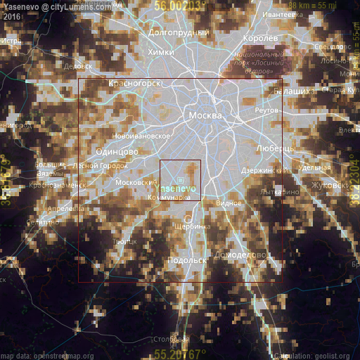
Analysis of Yasenevo night lights 2016
Square area 10x10 km:
 47.99%
90-99
31.2%80-89
8.4%70-79
10.53%60-69
1.88%50-59
0%40-49
0%30-39
0%20-29
0%10-19
0%0-9
0%Square area 50x50 km:
36.03%90-99
17.07%80-89
6.1%70-79
7.68%60-69
6.98%50-59
5.46%40-49
5.28%30-39
4.41%20-29
4.79%10-19
4.33%0-9
1.89%Clear (daylight) street map image can be seen on geolist.org.
Map coordinates:
56° 0' 7.3" North, 36° 49' 0.4" East
55° 36' 24.7" North, 37° 31' 11.7" East
55° 12' 27.6" North, 38° 13' 22.9" East
Some cities around Yasenevo sort by population:
• Chertanovo Yuzhnoye
5.1 km =3.2 mi,  110°
110°
• Tyoply Stan
2.3 km =1.4 mi,  312°
312°
• Zyuzino
6.3 km =3.9 mi,  29°
29°
• Troparëvo
5.9 km =3.7 mi,  338°
338°
• Cherëmushki
6.9 km =4.3 mi,  22°
22°
• Nagornyy
7.7 km =4.8 mi,  51°
51°
• Annino
5.7 km =3.5 mi,  117°
117°
• Mosrentgen
3.8 km =2.4 mi,  292°
292°
468809 (p: 180,000)
Sources (retrieved 2019-11-25):
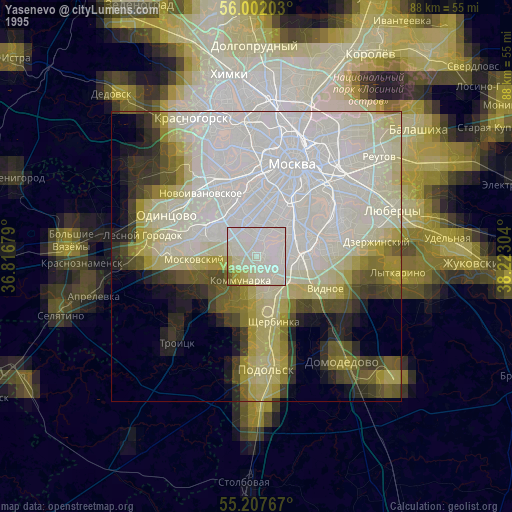
» NASA, Earths city lights 1995
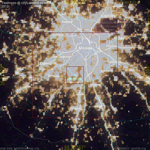
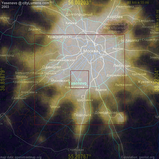
» NASA city lights 2003
» Earth at Night: Flat Maps 2012, 2016