Volgograd night lights from space
Night Light of Volgograd (Volgograd Oblast) from space (Russia) Src. Average luminocity for 10x10km area is 76.3125% and for 50x50km: 17.7035%.
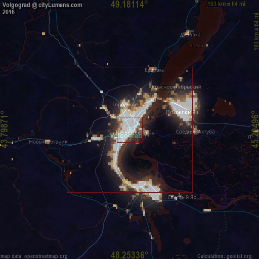

Analysis of Volgograd night lights 2016
Square area 10x10 km:
 28.57%
90-99
29.91%80-89
2.68%70-79
1.64%60-69
7.14%50-59
4.61%40-49
5.21%30-39
8.48%20-29
7.89%10-19
3.87%0-9
0%Square area 50x50 km:
4.01%90-99
4.15%80-89
1.4%70-79
1.13%60-69
2.01%50-59
1.84%40-49
1.91%30-39
2.46%20-29
5.72%10-19
10.35%0-9
65.03%Clear (daylight) street map image can be seen on geolist.org.
Map coordinates:
49° 10' 52.1" North, 43° 47' 55.4" East
48° 43' 9.8" North, 44° 30' 6.6" East
48° 15' 12.1" North, 45° 12' 17.9" East
Fantastic image of Volgograd from space taken by astronauts [src2], but I don't have information about it's orientation, scale or angle. If necessary, it was rotated manually, so North points approximately to upper direction. Click to zoom in:

Some cities around Volgograd sort by population:
• Volzhskiy
21.7 km =13.5 mi,  70°
70°
• Gorodishche
9.7 km =6 mi,  348°
348°
• Dubovka
44.6 km =27.7 mi,  32°
32°
• Krasnoslobodsk
5.7 km =3.5 mi,  103°
103°
• Srednyaya Akhtuba
26.8 km =16.7 mi,  92°
92°
• Svetlyy Yar
34.1 km =21.2 mi,  142°
142°
• Novyy Rogachik
32.7 km =20.3 mi,  261°
261°
• Gumrak
11.2 km =7 mi,  308°
308°
472757 (p: 1,011,417)
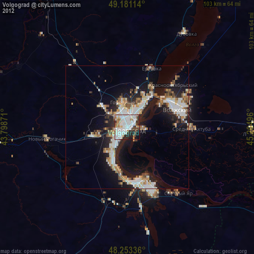
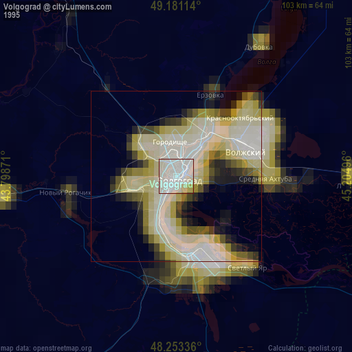
Sources (retrieved 2019-11-25):
» NASA, Earths city lights 1995
» NASA city lights 2003
» Earth at Night: Flat Maps 2012, 2016
Src.2: picture by Oleg Kononenko,ĀRoscosmos, retrieved 2019-11-29