Varenikovskaya night lights from space
Night Light of Varenikovskaya (Krasnodarskiy) from space (Russia) Src. Average luminocity for 10x10km area is 8.8924% and for 50x50km: 5.1978%.
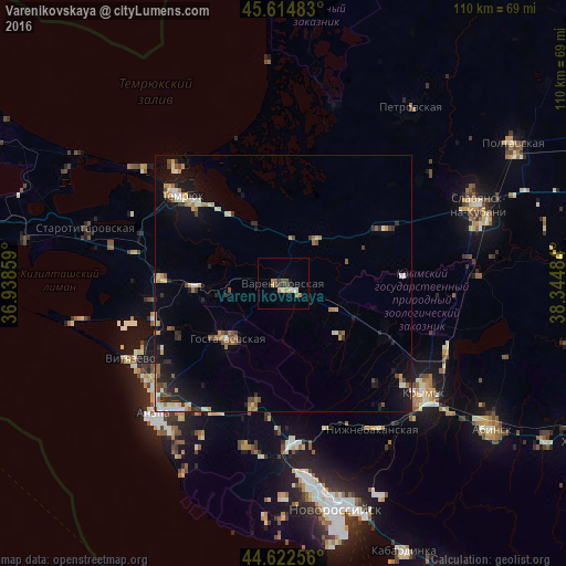
Analysis of Varenikovskaya night lights 2016
Square area 10x10 km:
 0.45%
0.45%90-99
1.52%80-89
1.06%70-79
1.36%60-69
1.06%50-59
1.21%40-49
2.42%30-39
0.91%20-29
1.52%10-19
0.61%0-9
87.88%Square area 50x50 km:
0.34%90-99
0.86%80-89
0.6%70-79
0.63%60-69
0.83%50-59
0.61%40-49
0.87%30-39
0.58%20-29
1.06%10-19
3.58%0-9
90.04%Clear (daylight) street map image can be seen on geolist.org.
Map coordinates:
45° 36' 53.4" North, 36° 56' 18.9" East
45° 7' 15.1" North, 37° 38' 30.2" East
44° 37' 21.2" North, 38° 20' 41.4" East
Some cities around Varenikovskaya sort by population:
• Temryuk
26 km =16.2 mi,  309°
309°
• Anapskaya
32 km =19.9 mi,  218°
218°
• Anastasiyevskaya
22.3 km =13.9 mi,  61°
61°
• Gostagayevskaya
15.3 km =9.5 mi, 224°
• Rayevskaya
32.4 km =20.1 mi,  192°
192°
• Verkhnebakanskiy
30.2 km =18.8 mi,  177°
177°
• Vityazevo
31.2 km =19.4 mi,  244°
244°
• Strelka
29.4 km =18.3 mi,  288°
288°
477039 (p: 14,409)
Sources (retrieved 2019-11-25):
» Earth at Night: Flat Maps 2012, 2016