Turuntayevo night lights from space
Night Light of Turuntayevo (Buryatiya Republic) from space (Russia) Src. Average luminocity for 10x10km area is 1.2897% and for 50x50km: 0.0791%.
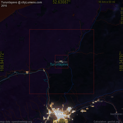
Analysis of Turuntayevo night lights 2016
Square area 10x10 km:
 0%
0%90-99
0%80-89
0%70-79
0%60-69
0%50-59
0%40-49
1.06%30-39
1.19%20-29
0.93%10-19
0%0-9
96.83%Square area 50x50 km:
0%90-99
0%80-89
0%70-79
0%60-69
0.02%50-59
0%40-49
0.06%30-39
0.05%20-29
0.04%10-19
0.02%0-9
99.81%Clear (daylight) street map image can be seen on geolist.org.
Map coordinates:
52° 37' 51.1" North, 106° 56' 30.2" East
52° 12' 7.3" North, 107° 38' 41.4" East
51° 46' 8.4" North, 108° 20' 52.7" East
Some cities around Turuntayevo sort by population:
• Ulan-Ude
41.8 km =26 mi,  183°
183°
• Onokhoy
41.9 km =26 mi,  136°
136°
• Zarechnyy
40.1 km =24.9 mi,  192°
192°
• Ivolginsk
56.1 km =34.9 mi,  206°
206°
• Kabansk
69.8 km =43.4 mi,  255°
255°
• Sokol
46.7 km =29 mi,  197°
197°
• Zaigrayevo
59 km =36.7 mi,  133°
133°
• Mukhorshibir’
128.7 km =80 mi,  174°
174°
2014779 (p: 6,260)
Sources (retrieved 2019-11-25):
» Earth at Night: Flat Maps 2012, 2016