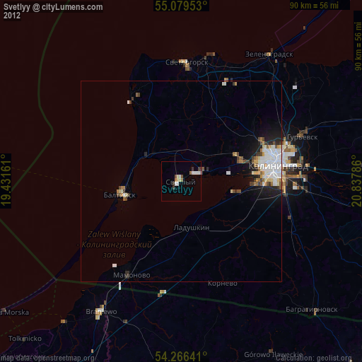
Svetlyy night lights from space
Night Light of Svetlyy (Kaliningrad) from space (Russia) Src. Average luminocity for 10x10km area is 11.2306% and for 50x50km: 5.2895%.
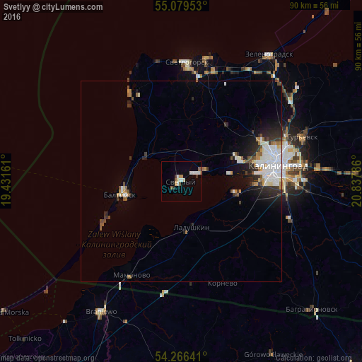
Analysis of Svetlyy night lights 2016
Square area 10x10 km:
 2.51%
2.51%90-99
2.38%80-89
1.38%70-79
0.88%60-69
0.75%50-59
1.38%40-49
0.38%30-39
1.38%20-29
0%10-19
0.25%0-9
88.72%Square area 50x50 km:
1.4%90-99
1.17%80-89
0.28%70-79
0.41%60-69
0.46%50-59
0.55%40-49
0.43%30-39
0.71%20-29
1.23%10-19
2.22%0-9
91.16%Clear (daylight) street map image can be seen on geolist.org.
Map coordinates:
55° 4' 46.3" North, 19° 25' 53.8" East
54° 40' 30" North, 20° 8' 5" East
54° 15' 59.1" North, 20° 50' 16.3" East
Some cities around Svetlyy sort by population:
• Kaliningrad
24.4 km =15.2 mi,  81°
81°
• Baltiysk
14.7 km =9.1 mi,  261°
261°
• Braniewo, PL
38.6 km =24 mi,  211°
211°
• Zelenogradsk
38.4 km =23.9 mi,  34°
34°
• Pionerskiy
31.2 km =19.4 mi,  10°
10°
• Gur’yevsk
32.1 km =19.9 mi,  70°
70°
• Mamonovo
26.6 km =16.5 mi, 208°
• Yantarnyy
25.1 km =15.6 mi,  330°
330°
485660 (p: 22,119)
Sources (retrieved 2019-11-25):
» Earth at Night: Flat Maps 2012, 2016