Soldato-Aleksandrovskoye night lights from space
Night Light of Soldato-Aleksandrovskoye (Stavropol’ Kray) from space (Russia) Src. Average luminocity for 10x10km area is 0.1939% and for 50x50km: 0.7117%.
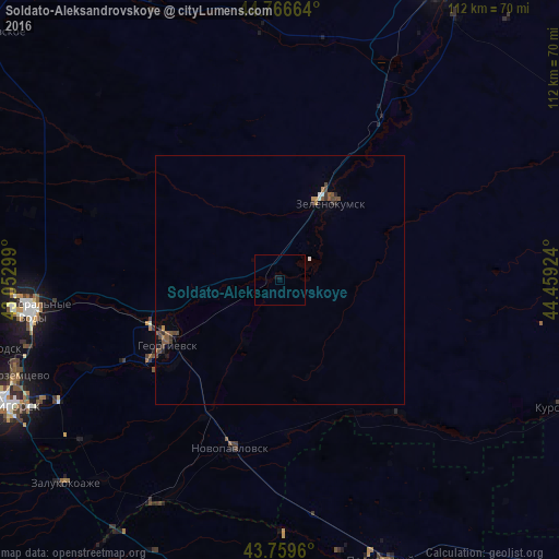
Analysis of Soldato-Aleksandrovskoye night lights 2016
Square area 10x10 km:
 0%
0%90-99
0%80-89
0%70-79
0%60-69
0%50-59
0%40-49
0%30-39
0%20-29
0%10-19
0.91%0-9
99.09%Square area 50x50 km:
0.04%90-99
0.05%80-89
0.01%70-79
0.05%60-69
0.11%50-59
0.25%40-49
0.3%30-39
0.18%20-29
0.12%10-19
0.09%0-9
98.8%Clear (daylight) street map image can be seen on geolist.org.
Map coordinates:
44° 45' 59.9" North, 43° 3' 10.8" East
44° 15' 55" North, 43° 45' 22" East
43° 45' 34.6" North, 44° 27' 33.3" East
Some cities around Soldato-Aleksandrovskoye sort by population:
• Georgiyevsk
26.1 km =16.2 mi,  241°
241°
• Zelenokumsk
18.6 km =11.6 mi,  32°
32°
• Nezlobnaya
32.6 km =20.3 mi, 239°
• Krasnokumskoye
22.5 km =14 mi, 244°
• Aleksandriyskaya
33 km =20.5 mi,  262°
262°
• Georgiyevskaya
27.1 km =16.8 mi,  230°
230°
• Podgornaya
26.9 km =16.7 mi, 255°
• Novozavedennoye
9.4 km =5.8 mi,  268°
268°
491085 (p: 11,059)
Sources (retrieved 2019-11-25):
» Earth at Night: Flat Maps 2012, 2016