Sarov night lights from space
Night Light of Sarov (Nizhny Novgorod Oblast) from space (Russia) Src. Average luminocity for 10x10km area is 24.6112% and for 50x50km: 1.2498%.
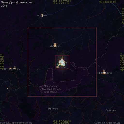
Analysis of Sarov night lights 2016
Square area 10x10 km:
 4.78%
4.78%90-99
5.86%80-89
1.91%70-79
3.11%60-69
2.27%50-59
3.11%40-49
1.44%30-39
0.48%20-29
0.84%10-19
30.86%0-9
45.33%Square area 50x50 km:
0.2%90-99
0.26%80-89
0.08%70-79
0.18%60-69
0.15%50-59
0.17%40-49
0.08%30-39
0.02%20-29
0.03%10-19
1.38%0-9
97.44%Clear (daylight) street map image can be seen on geolist.org.
Map coordinates:
55° 20' 15.9" North, 42° 37' 13.4" East
54° 56' 9" North, 43° 19' 24.7" East
54° 31' 47.5" North, 44° 1' 35.9" East
Some cities around Sarov sort by population:
• Pervomaysk
31.5 km =19.6 mi,  103°
103°
• Shatki
58.3 km =36.2 mi,  61°
61°
• Ardatov
37 km =23 mi,  337°
337°
• Temnikov
34.7 km =21.6 mi,  191°
191°
• Vyyezdnoye
57.6 km =35.8 mi,  30°
30°
• Diveyevo
13 km =8.1 mi, 336°
• Voznesenskoye
36.6 km =22.7 mi,  261°
261°
• Gremyachevo
54.1 km =33.6 mi, 339°
498525 (p: 88,000)
Sources (retrieved 2019-11-25):
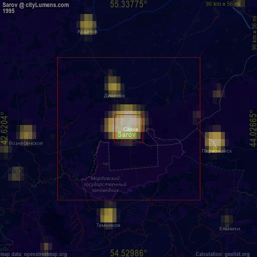
» NASA, Earths city lights 1995
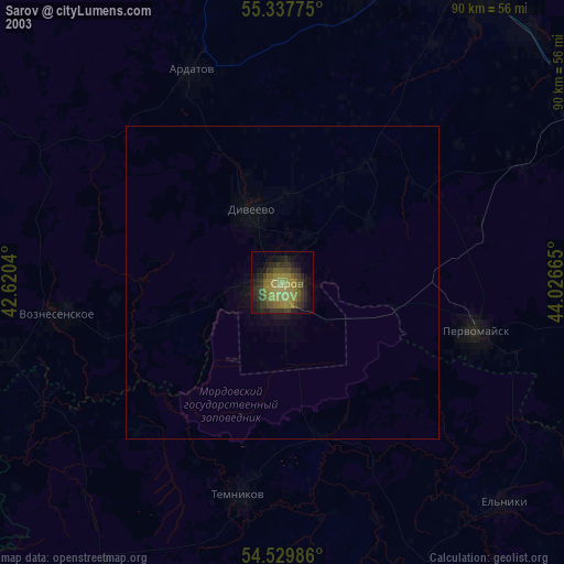
» NASA city lights 2003
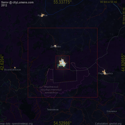
» Earth at Night: Flat Maps 2012, 2016