Romodanovo night lights from space
Night Light of Romodanovo (Mordoviya Republic) from space (Russia) Src. Average luminocity for 10x10km area is 0.6842% and for 50x50km: 2.7433%.
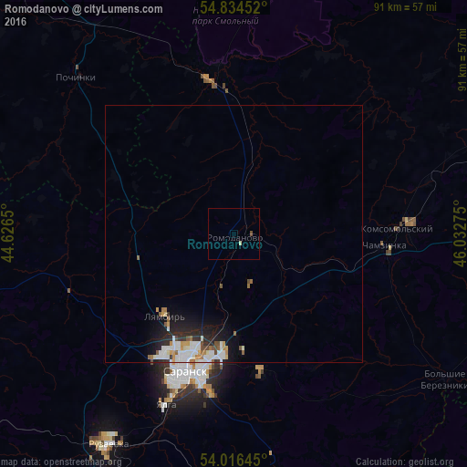
Analysis of Romodanovo night lights 2016
Square area 10x10 km:
 0%
0%90-99
0.48%80-89
0%70-79
0%60-69
0%50-59
0%40-49
0.48%30-39
0%20-29
0%10-19
0%0-9
99.04%Square area 50x50 km:
0.66%90-99
0.71%80-89
0.13%70-79
0.3%60-69
0.27%50-59
0.25%40-49
0.25%30-39
0.16%20-29
0.83%10-19
1.61%0-9
94.82%Clear (daylight) street map image can be seen on geolist.org.
Map coordinates:
54° 50' 4.3" North, 44° 37' 35.4" East
54° 25' 39.1" North, 45° 19' 46.6" East
54° 0' 59.2" North, 46° 1' 57.9" East
Some cities around Romodanovo sort by population:
• Saransk
28.9 km =18 mi,  200°
200°
• Ruzayevka
47.3 km =29.4 mi,  211°
211°
• Pochinki
42.4 km =26.3 mi,  315°
315°
• Chamzinka
29.5 km =18.3 mi,  95°
95°
• Lukhovka
31.4 km =19.5 mi,  188°
188°
• Lyambir’
20.9 km =13 mi,  219°
219°
• Atyashevo
50.1 km =31.1 mi,  72°
72°
• Nikolayevka
33.6 km =20.9 mi, 200°
501349 (p: 9,646)
Sources (retrieved 2019-11-25):
» Earth at Night: Flat Maps 2012, 2016