Pestovo night lights from space
Night Light of Pestovo (Novgorod Oblast) from space (Russia) Src. Average luminocity for 10x10km area is 9.8777% and for 50x50km: 0.4318%.
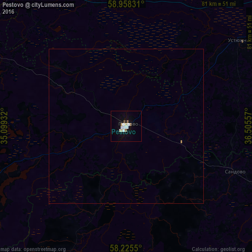
Analysis of Pestovo night lights 2016
Square area 10x10 km:
 2.6%
2.6%90-99
2.16%80-89
1.3%70-79
0%60-69
0.76%50-59
1.41%40-49
0%30-39
0%20-29
0.43%10-19
2.16%0-9
89.18%Square area 50x50 km:
0.11%90-99
0.09%80-89
0.05%70-79
0.02%60-69
0.03%50-59
0.06%40-49
0%30-39
0%20-29
0.02%10-19
0.09%0-9
99.54%Clear (daylight) street map image can be seen on geolist.org.
Map coordinates:
58° 57' 29.9" North, 35° 5' 57.6" East
58° 35' 37.8" North, 35° 48' 8.8" East
58° 13' 31.8" North, 36° 30' 20.1" East
Some cities around Pestovo sort by population:
• Udomlya
92.5 km =57.5 mi,  210°
210°
• Babayevo
89.3 km =55.5 mi,  4°
4°
• Ustyuzhna
45.5 km =28.3 mi,  53°
53°
• Maksatikha
88.7 km =55.1 mi,  176°
176°
• Ves’yegonsk
84.7 km =52.6 mi,  84°
84°
• Chagoda
69 km =42.9 mi,  336°
336°
• Khvoynaya
80.7 km =50.1 mi,  294°
294°
• Krasnyy Kholm
97.1 km =60.3 mi,  127°
127°
510364 (p: 15,910)
Sources (retrieved 2019-11-25):
» Earth at Night: Flat Maps 2012, 2016