Pervomayskoye night lights from space
Night Light of Pervomayskoye (Altai Krai) from space (Russia) Src. Average luminocity for 10x10km area is 2.5053% and for 50x50km: 1.8321%.
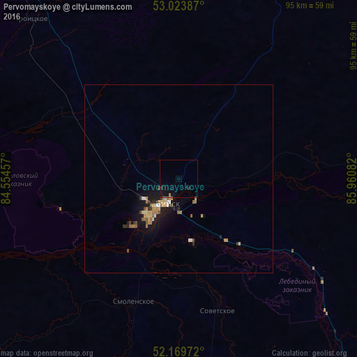
Analysis of Pervomayskoye night lights 2016
Square area 10x10 km:
 0%
0%90-99
0%80-89
0%70-79
0.26%60-69
0.26%50-59
0.26%40-49
0%30-39
0.53%20-29
0.53%10-19
4.63%0-9
93.52%Square area 50x50 km:
0.11%90-99
0.12%80-89
0.36%70-79
0.33%60-69
0.37%50-59
0.27%40-49
0.1%30-39
0.25%20-29
0.23%10-19
1.88%0-9
96%Clear (daylight) street map image can be seen on geolist.org.
Map coordinates:
53° 1' 25.9" North, 84° 33' 16.5" East
52° 35' 56" North, 85° 15' 27.7" East
52° 10' 11" North, 85° 57' 39" East
Some cities around Pervomayskoye sort by population:
• Biysk
7.7 km =4.8 mi,  206°
206°
• Belokurikha
69.5 km =43.2 mi,  195°
195°
• Altayskoye
72 km =44.7 mi,  175°
175°
• Troitskoye
57.7 km =35.9 mi,  317°
317°
• Smolenskoye
34.9 km =21.7 mi, 200°
• Krasnogorskoye
72.1 km =44.8 mi,  117°
117°
• Tselinnoye
59.6 km =37 mi,  26°
26°
• Sovetskoye
36.4 km =22.6 mi,  163°
163°
6610738 (p: 6,500)
Sources (retrieved 2019-11-25):
» Earth at Night: Flat Maps 2012, 2016