Korotchaevo night lights from space
Night Light of Korotchaevo (Yamalo-Nenets) from space (Russia) Src. Average luminocity for 10x10km area is 12.3059% and for 50x50km: 0.8418%.
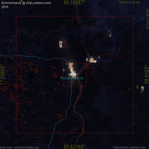
Analysis of Korotchaevo night lights 2016
Square area 10x10 km:
 1.4%
1.4%90-99
1.92%80-89
0.52%70-79
0%60-69
5.24%50-59
2.45%40-49
1.05%30-39
0.35%20-29
1.31%10-19
9.27%0-9
76.49%Square area 50x50 km:
0.07%90-99
0.13%80-89
0.03%70-79
0.01%60-69
0.38%50-59
0.13%40-49
0.07%30-39
0.05%20-29
0.11%10-19
0.5%0-9
98.52%Clear (daylight) street map image can be seen on geolist.org.
Map coordinates:
66° 11' 44.4" North, 77° 30' 21.8" East
65° 54' 37" North, 78° 12' 33" East
65° 37' 18" North, 78° 54' 44.3" East
Some cities around Korotchaevo sort by population:
• Novyy Urengoy
73.8 km =45.9 mi,  285°
285°
• Nadym
263.5 km =163.7 mi,  260°
260°
• Gubkinskiy
182.4 km =113.3 mi,  205°
205°
• Tarko-Sale
112.4 km =69.8 mi,  190°
190°
• Pangody
169.3 km =105.2 mi,  267°
267°
• Urengoy
9.5 km =5.9 mi,  49°
49°
• Purpe
174.1 km =108.2 mi,  204°
204°
• Tazovsky
175 km =108.7 mi,  7°
7°
11888187 (p: 6,998)
Sources (retrieved 2019-11-25):
» Earth at Night: Flat Maps 2012, 2016