Neklyudovo night lights from space
Night Light of Neklyudovo (Nizhny Novgorod Oblast) from space (Russia) Src. Average luminocity for 10x10km area is 19.2476% and for 50x50km: 16.3175%.
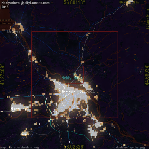
Analysis of Neklyudovo night lights 2016
Square area 10x10 km:
 0.71%
0.71%90-99
2.98%80-89
3.45%70-79
1.43%60-69
3.69%50-59
2.26%40-49
0.48%30-39
0.71%20-29
11.55%10-19
23.93%0-9
48.81%Square area 50x50 km:
4.82%90-99
4.16%80-89
1.19%70-79
1.14%60-69
1.49%50-59
1.23%40-49
1.21%30-39
2.41%20-29
4.02%10-19
6.97%0-9
71.36%Clear (daylight) street map image can be seen on geolist.org.
Map coordinates:
56° 48' 4.2" North, 43° 16' 26.7" East
56° 24' 51.2" North, 43° 58' 38" East
56° 1' 23.7" North, 44° 40' 49.2" East
Some cities around Neklyudovo sort by population:
• Nizhniy Novgorod
9.6 km =6 mi,  170°
170°
• Dzerzhinsk
37.5 km =23.3 mi,  239°
239°
• Kstovo
32.7 km =20.3 mi,  155°
155°
• Novaya Balakhna
24.6 km =15.3 mi,  290°
290°
• Bor
8.7 km =5.4 mi,  136°
136°
• Gidrotorf
27.8 km =17.3 mi,  284°
284°
• Bol’shoye Kozino
16.2 km =10.1 mi,  265°
265°
• Linda
23.5 km =14.6 mi,  17°
17°
522871 (p: 9,052)
Sources (retrieved 2019-11-25):
» Earth at Night: Flat Maps 2012, 2016