Gidrotorf night lights from space
Night Light of Gidrotorf (Nizhny Novgorod Oblast) from space (Russia) Src. Average luminocity for 10x10km area is 7.6114% and for 50x50km: 8.2587%.
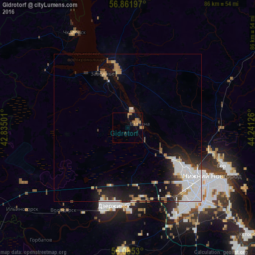
Analysis of Gidrotorf night lights 2016
Square area 10x10 km:
 0%
0%90-99
0%80-89
0.34%70-79
3.18%60-69
2.95%50-59
1.7%40-49
0%30-39
0.45%20-29
0%10-19
1.25%0-9
90.11%Square area 50x50 km:
2.18%90-99
1.94%80-89
0.46%70-79
0.82%60-69
1.01%50-59
0.72%40-49
0.49%30-39
0.7%20-29
2%10-19
4.19%0-9
85.5%Clear (daylight) street map image can be seen on geolist.org.
Map coordinates:
56° 51' 43.1" North, 42° 50' 6" East
56° 28' 32.2" North, 43° 32' 17.3" East
56° 5' 7.1" North, 44° 14' 28.5" East
Some cities around Gidrotorf sort by population:
• Nizhniy Novgorod
32.9 km =20.4 mi,  119°
119°
• Dzerzhinsk
26.5 km =16.5 mi,  191°
191°
• Novaya Balakhna
4.2 km =2.6 mi,  67°
67°
• Zavolzh’ye
20.3 km =12.6 mi,  334°
334°
• Gorodets
20.3 km =12.6 mi,  348°
348°
• Neklyudovo
27.8 km =17.3 mi,  104°
104°
• Bol’shoye Kozino
13.4 km =8.3 mi,  126°
126°
• Reshetikha
32.8 km =20.4 mi,  208°
208°
561504 (p: 7,424)
Sources (retrieved 2019-11-25):
» Earth at Night: Flat Maps 2012, 2016