Mikhaylovskoye night lights from space
Night Light of Mikhaylovskoye (North Ossetia) from space (Russia) Src. Average luminocity for 10x10km area is 35.053% and for 50x50km: 14.5108%.
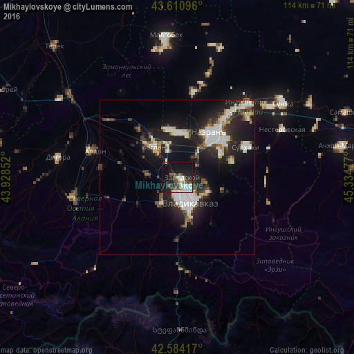
Analysis of Mikhaylovskoye night lights 2016
Square area 10x10 km:
 7.88%
7.88%90-99
9.09%80-89
1.52%70-79
1.67%60-69
2.27%50-59
3.64%40-49
5.45%30-39
4.09%20-29
12.12%10-19
30.91%0-9
21.36%Square area 50x50 km:
2.9%90-99
3.32%80-89
1.02%70-79
0.86%60-69
1.04%50-59
1.31%40-49
1.84%30-39
2.2%20-29
5.49%10-19
12.56%0-9
67.45%Clear (daylight) street map image can be seen on geolist.org.
Map coordinates:
43° 36' 39.5" North, 43° 55' 42.7" East
43° 5' 59" North, 44° 37' 53.9" East
42° 35' 3" North, 45° 20' 5.2" East
Some cities around Mikhaylovskoye sort by population:
• Vladikavkaz
7.6 km =4.7 mi,  157°
157°
• Beslan
12.5 km =7.8 mi,  325°
325°
• Kantyshevo
14.3 km =8.9 mi,  0°
0°
• Nogir
2.1 km =1.3 mi,  168°
168°
• Chermen
8.7 km =5.4 mi,  48°
48°
• Arkhonskaya
9.7 km =6 mi,  276°
276°
• Kambileyevskoye
10.1 km =6.3 mi,  103°
103°
• Gizel’
8.3 km =5.2 mi,  216°
216°
526749 (p: 10,479)
Sources (retrieved 2019-11-25):
» Earth at Night: Flat Maps 2012, 2016