Vladikavkaz night lights from space
Night Light of Vladikavkaz (North Ossetia) from space (Russia) Src. Average luminocity for 10x10km area is 67.981% and for 50x50km: 12.5089%.
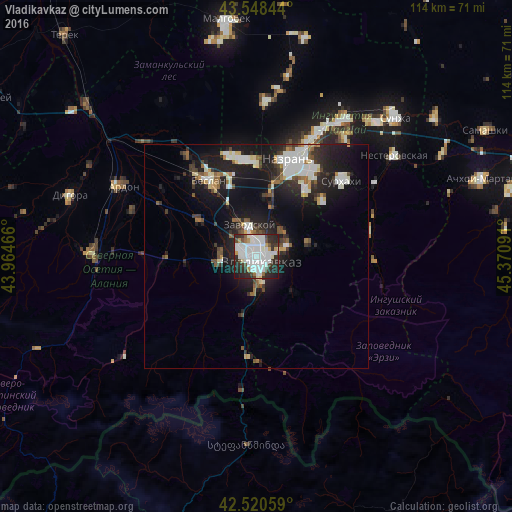
Analysis of Vladikavkaz night lights 2016
Square area 10x10 km:
 26.19%
90-99
24.29%80-89
2.38%70-79
3.49%60-69
2.06%50-59
1.75%40-49
5.87%30-39
6.67%20-29
22.7%10-19
4.6%0-9
0%Square area 50x50 km:
2.59%90-99
2.83%80-89
0.89%70-79
0.7%60-69
0.92%50-59
1.15%40-49
1.49%30-39
1.77%20-29
4.56%10-19
11.13%0-9
71.97%Clear (daylight) street map image can be seen on geolist.org.
Map coordinates:
43° 32' 54.4" North, 43° 57' 52.8" East
43° 2' 12" North, 44° 40' 4" East
42° 31' 14.1" North, 45° 22' 15.3" East
Some cities around Vladikavkaz sort by population:
• Sunzha
12.8 km =8 mi,  79°
79°
• Nogir
5.6 km =3.5 mi,  333°
333°
• Mikhaylovskoye
7.6 km =4.7 mi,  337°
337°
• Chermen
13.3 km =8.3 mi,  15°
15°
• Arkhonskaya
15 km =9.3 mi,  302°
302°
• Kambileyevskoye
8.3 km =5.2 mi,  55°
55°
• Ali-Yurt
19.1 km =11.9 mi,  51°
51°
• Gizel’
7.9 km =4.9 mi,  272°
272°
473249 (p: 317,370)
Sources (retrieved 2019-11-25):
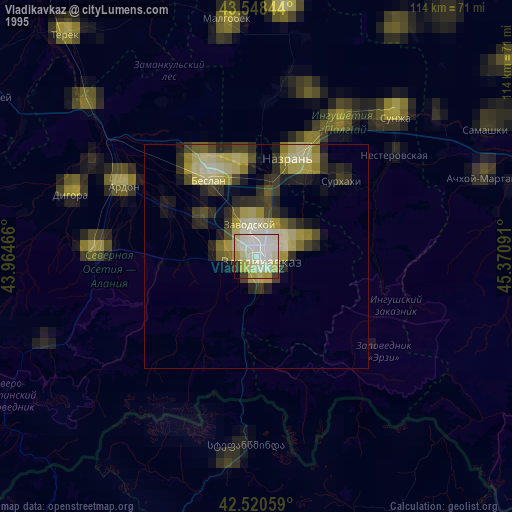
» NASA, Earths city lights 1995
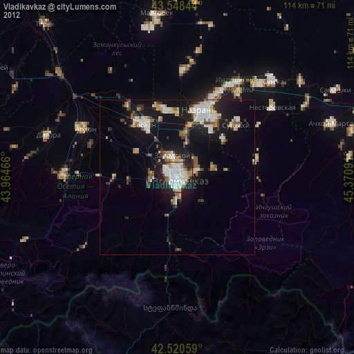
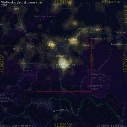
» NASA city lights 2003
» Earth at Night: Flat Maps 2012, 2016