Lyubertsy night lights from space
Night Light of Lyubertsy (Moscow Oblast) from space (Russia) Src. Average luminocity for 10x10km area is 94.7392% and for 50x50km: 65.2359%.
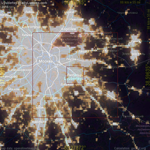
Analysis of Lyubertsy night lights 2016
Square area 10x10 km:
 54.67%
90-99
27.63%80-89
5.86%70-79
5.74%60-69
5.38%50-59
0.48%40-49
0.24%30-39
0%20-29
0%10-19
0%0-9
0%Square area 50x50 km:
29.72%90-99
12.95%80-89
4.56%70-79
5.8%60-69
5.59%50-59
4.63%40-49
5.5%30-39
6.89%20-29
9.22%10-19
9.01%0-9
6.12%Clear (daylight) street map image can be seen on geolist.org.
Map coordinates:
56° 4' 17.9" North, 37° 11' 24.4" East
55° 40' 37.9" North, 37° 53' 35.6" East
55° 16' 43.4" North, 38° 35' 46.9" East
Some cities around Lyubertsy sort by population:
• Vykhino-Zhulebino
5.8 km =3.6 mi,  298°
298°
• Zhulebino
3.7 km =2.3 mi,  313°
313°
• Kuz’minki
6.4 km =4 mi,  293°
293°
• Dzerzhinsky
6 km =3.7 mi,  201°
201°
• Dzerzhinskiy
5.8 km =3.6 mi, 203°
• Tomilino
4.1 km =2.5 mi,  124°
124°
• Kotel’niki
5.6 km =3.5 mi,  213°
213°
• Nekrasovka
2.1 km =1.3 mi,  32°
32°
532615 (p: 154,650)
Sources (retrieved 2019-11-25):
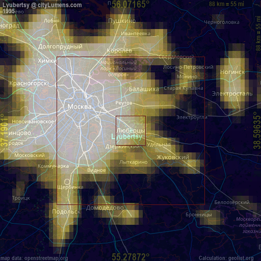
» NASA, Earths city lights 1995
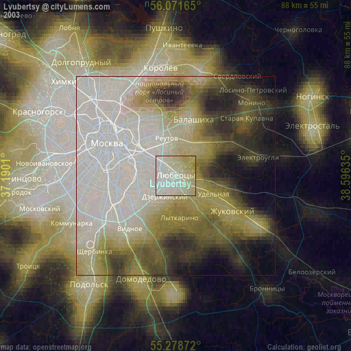
» NASA city lights 2003
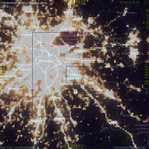
» Earth at Night: Flat Maps 2012, 2016