Lipetsk night lights from space
Night Light of Lipetsk (Lipetsk Oblast) from space (Russia) Src. Average luminocity for 10x10km area is 77.0952% and for 50x50km: 9.3509%.
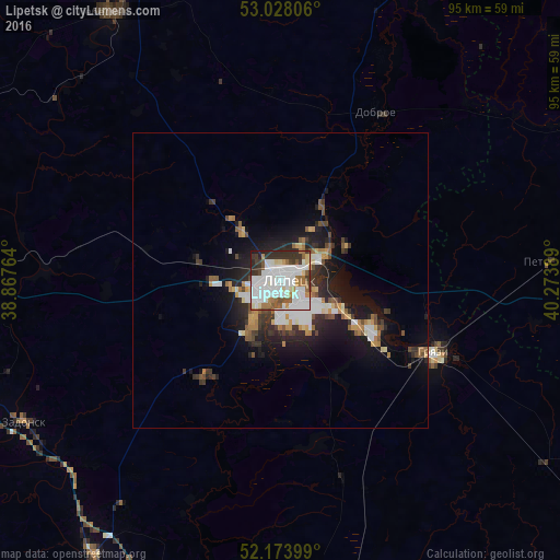
Analysis of Lipetsk night lights 2016
Square area 10x10 km:
 29.89%
90-99
25.79%80-89
4.63%70-79
3.97%60-69
7.01%50-59
7.01%40-49
3.31%30-39
10.85%20-29
6.35%10-19
1.19%0-9
0%Square area 50x50 km:
1.96%90-99
1.85%80-89
0.62%70-79
1.01%60-69
1.04%50-59
0.98%40-49
1%30-39
1.63%20-29
2.58%10-19
6.31%0-9
81%Clear (daylight) street map image can be seen on geolist.org.
Map coordinates:
53° 1' 41" North, 38° 52' 3.5" East
52° 36' 11.2" North, 39° 34' 14.7" East
52° 10' 26.4" North, 40° 16' 26" East
Some cities around Lipetsk sort by population:
• Gryazi
27.4 km =17 mi,  115°
115°
• Lebedyan’
53.7 km =33.4 mi,  329°
329°
• Usman’
62.8 km =39 mi,  170°
170°
• Zadonsk
49.6 km =30.8 mi,  241°
241°
• Lev Tolstoy
68.4 km =42.5 mi,  352°
352°
• Khlevnoye
55.7 km =34.6 mi,  215°
215°
• Borinskoye
21.1 km =13.1 mi, 219°
• Dobroye
33.6 km =20.9 mi,  28°
28°
535121 (p: 515,655)
Sources (retrieved 2019-11-25):
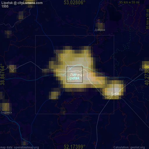
» NASA, Earths city lights 1995
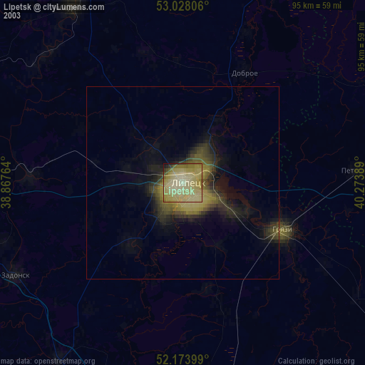
» NASA city lights 2003
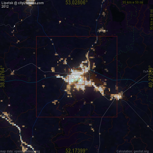
» Earth at Night: Flat Maps 2012, 2016