Dobroye night lights from space
Night Light of Dobroye (Lipetsk Oblast) from space (Russia) Src. Average luminocity for 10x10km area is 0.471% and for 50x50km: 1.073%.
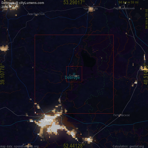
Analysis of Dobroye night lights 2016
Square area 10x10 km:
 0%
0%90-99
0%80-89
0%70-79
0%60-69
0%50-59
0%40-49
0%30-39
1.01%20-29
0.51%10-19
0%0-9
98.48%Square area 50x50 km:
0.01%90-99
0.02%80-89
0.07%70-79
0.12%60-69
0.24%50-59
0.2%40-49
0.2%30-39
0.18%20-29
0.57%10-19
1.46%0-9
96.95%Clear (daylight) street map image can be seen on geolist.org.
Map coordinates:
53° 17' 24.6" North, 39° 6' 28" East
52° 52' 4.1" North, 39° 48' 39.2" East
52° 26' 28.6" North, 40° 30' 50.5" East
Some cities around Dobroye sort by population:
• Lipetsk
33.6 km =20.9 mi,  208°
208°
• Michurinsk
45.7 km =28.4 mi,  85°
85°
• Gryazi
42.1 km =26.2 mi,  168°
168°
• Lebedyan’
46.4 km =28.8 mi,  291°
291°
• Chaplygin
43 km =26.7 mi,  13°
13°
• Pervomayskiy
53 km =32.9 mi,  36°
36°
• Lev Tolstoy
45.5 km =28.3 mi,  327°
327°
• Zavoronezhskoye
49.8 km =30.9 mi, 88°
565803 (p: 5,550)
Sources (retrieved 2019-11-25):
» Earth at Night: Flat Maps 2012, 2016