Usman’ night lights from space
Night Light of Usman’ (Lipetsk Oblast) from space (Russia) Src. Average luminocity for 10x10km area is 12.0126% and for 50x50km: 0.6161%.
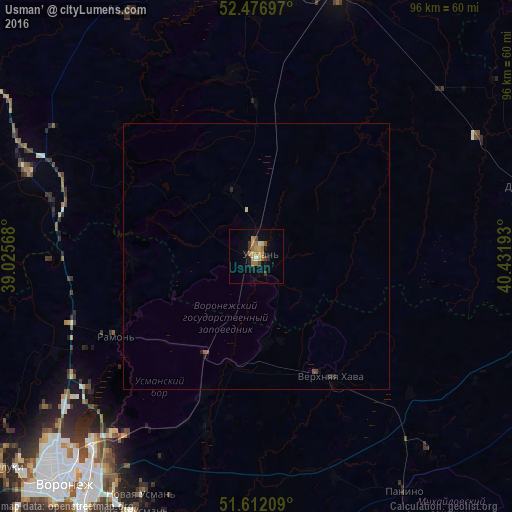

Analysis of Usman’ night lights 2016
Square area 10x10 km:
 0.25%
0.25%90-99
0.76%80-89
1.14%70-79
3.54%60-69
4.29%50-59
0.63%40-49
1.14%30-39
1.89%20-29
1.01%10-19
3.91%0-9
81.44%Square area 50x50 km:
0.01%90-99
0.04%80-89
0.06%70-79
0.15%60-69
0.18%50-59
0.05%40-49
0.11%30-39
0.08%20-29
0.15%10-19
0.21%0-9
98.97%Clear (daylight) street map image can be seen on geolist.org.
Map coordinates:
52° 28' 37.1" North, 39° 1' 32.4" East
52° 2' 47.8" North, 39° 43' 43.7" East
51° 36' 43.5" North, 40° 25' 54.9" East
Some cities around Usman’ sort by population:
• Novaya Usman’
50.1 km =31.1 mi,  206°
206°
• Somovo
42.1 km =26.2 mi,  216°
216°
• Ramon’
30.6 km =19 mi,  241°
241°
• Verkhnyaya Khava
27.2 km =16.9 mi,  147°
147°
• Volya
33.9 km =21.1 mi,  202°
202°
• Khlevnoye
46.4 km =28.8 mi,  290°
290°
• Borinskoye
51.7 km =32.1 mi,  331°
331°
• Krasnolesnyy
20.8 km =12.9 mi, 207°
478317 (p: 19,910)
Sources (retrieved 2019-11-25):
» Earth at Night: Flat Maps 2012, 2016