Leninaul night lights from space
Night Light of Leninaul (Dagestan) from space (Russia) Src. Average luminocity for 10x10km area is 12.7955% and for 50x50km: 10.7695%.
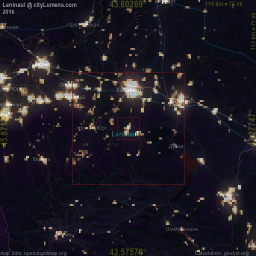
Analysis of Leninaul night lights 2016
Square area 10x10 km:
 0.91%
0.91%90-99
1.52%80-89
2.42%70-79
1.82%60-69
1.82%50-59
2.12%40-49
0.91%30-39
1.82%20-29
0%10-19
0.45%0-9
86.21%Square area 50x50 km:
1.08%90-99
1.63%80-89
0.97%70-79
1.25%60-69
1.21%50-59
1.38%40-49
2.03%30-39
1.73%20-29
3.07%10-19
7.81%0-9
77.84%Clear (daylight) street map image can be seen on geolist.org.
Map coordinates:
43° 36' 9.7" North, 45° 52' 16.4" East
43° 5' 29" North, 46° 34' 27.6" East
42° 34' 32.7" North, 47° 16' 38.9" East
Some cities around Leninaul sort by population:
• Khasavyurt
17.8 km =11.1 mi,  3°
3°
• Dylym
5.4 km =3.4 mi,  114°
114°
• Endirey
10.3 km =6.4 mi,  39°
39°
• Mutsalaul
24.1 km =15 mi,  31°
31°
• Dubki
22.8 km =14.2 mi, 110°
• Novyy Sulak
22.8 km =14.2 mi,  63°
63°
• Bavtugay
22.7 km =14.1 mi,  67°
67°
• Nozhay-Yurt
15.9 km =9.9 mi,  270°
270°
536209 (p: 7,503)
Sources (retrieved 2019-11-25):
» Earth at Night: Flat Maps 2012, 2016