Kursk night lights from space
Night Light of Kursk from space (Russia) Src. Average luminocity for 10x10km area is 60.9538% and for 50x50km: 5.0656%.
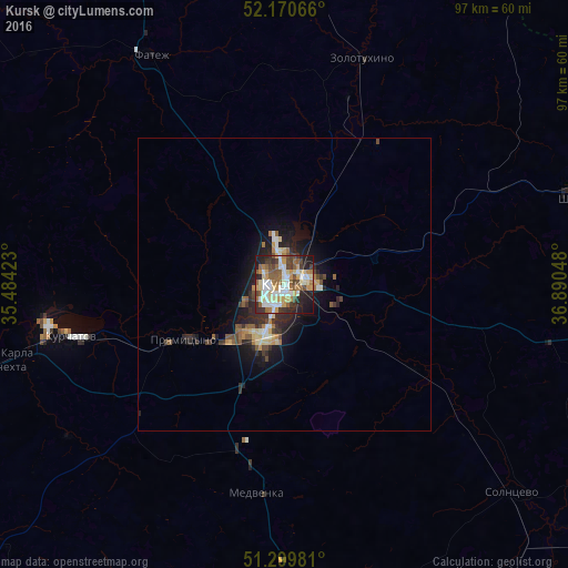
Analysis of Kursk night lights 2016
Square area 10x10 km:
 11.34%
90-99
12.46%80-89
9.24%70-79
10.22%60-69
6.86%50-59
13.03%40-49
8.26%30-39
7%20-29
12.89%10-19
8.54%0-9
0.14%Square area 50x50 km:
0.59%90-99
0.73%80-89
0.68%70-79
0.62%60-69
0.62%50-59
0.93%40-49
0.76%30-39
0.9%20-29
1.66%10-19
3.25%0-9
89.25%Clear (daylight) street map image can be seen on geolist.org.
Map coordinates:
52° 10' 14.4" North, 35° 29' 3.2" East
51° 44' 14.4" North, 36° 11' 14.5" East
51° 17' 59.3" North, 36° 53' 25.7" East
Some cities around Kursk sort by population:
• Kurchatov
37.9 km =23.5 mi,  256°
256°
• L’govskiy
63.8 km =39.6 mi, 259°
• Shchigry
51.6 km =32.1 mi,  72°
72°
• Oboyan’
59 km =36.7 mi,  173°
173°
• Ivnya
75.1 km =46.7 mi,  182°
182°
• Fatezh
45 km =28 mi,  330°
330°
• Pristen’
66 km =41 mi,  147°
147°
• Pryamitsyno
19.8 km =12.3 mi,  242°
242°
538560 (p: 409,431)
Sources (retrieved 2019-11-25):
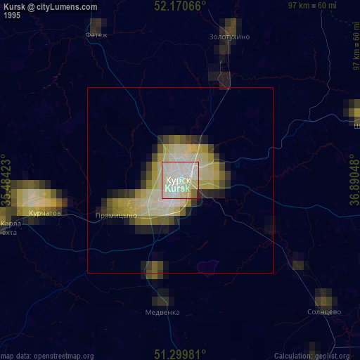
» NASA, Earths city lights 1995
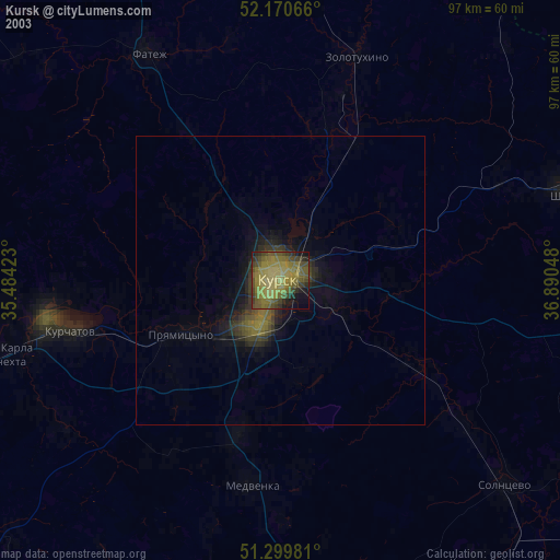
» NASA city lights 2003
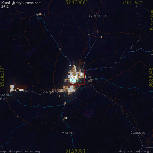
» Earth at Night: Flat Maps 2012, 2016