Kirishi night lights from space
Night Light of Kirishi (Leningradskaya Oblast') from space (Russia) Src. Average luminocity for 10x10km area is 27.3034% and for 50x50km: 1.5863%.
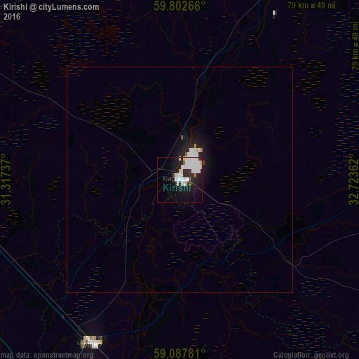
Analysis of Kirishi night lights 2016
Square area 10x10 km:
 9.62%
9.62%90-99
8.14%80-89
1.9%70-79
0.21%60-69
0.42%50-59
0.85%40-49
0.11%30-39
2.85%20-29
7.82%10-19
20.61%0-9
47.46%Square area 50x50 km:
0.47%90-99
0.42%80-89
0.1%70-79
0.03%60-69
0.03%50-59
0.06%40-49
0.03%30-39
0.12%20-29
0.47%10-19
1.7%0-9
96.57%Clear (daylight) street map image can be seen on geolist.org.
Map coordinates:
59° 48' 9.6" North, 31° 19' 2.5" East
59° 26' 49.6" North, 32° 1' 13.8" East
59° 5' 16.1" North, 32° 43' 25" East
Some cities around Kirishi sort by population:
• Volkhov
56.1 km =34.9 mi,  18°
18°
• Tosno
65.3 km =40.6 mi,  279°
279°
• Chudovo
41.4 km =25.7 mi,  207°
207°
• Malaya Vishera
67.9 km =42.2 mi,  170°
170°
• Novaya Ladoga
74.5 km =46.3 mi,  12°
12°
• Mga
63.4 km =39.4 mi,  302°
302°
• Ul’yanovka
73.9 km =45.9 mi,  286°
286°
• Priladozhskiy
61.6 km =38.3 mi,  320°
320°
548442 (p: 56,190)
Sources (retrieved 2019-11-25):
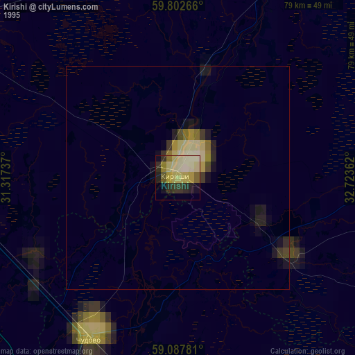
» NASA, Earths city lights 1995
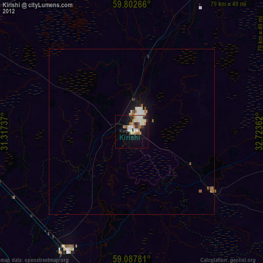
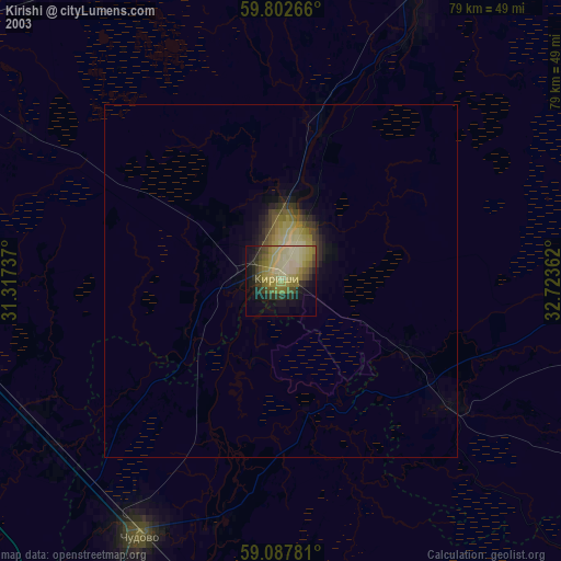
» NASA city lights 2003
» Earth at Night: Flat Maps 2012, 2016