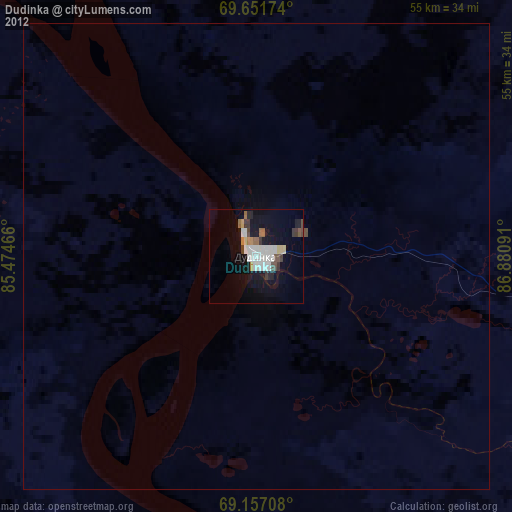
Dudinka night lights from space
Night Light of Dudinka (Krasnoyarskiy) from space (Russia) Src. Average luminocity for 10x10km area is 17.8011% and for 50x50km: 0.7786%.
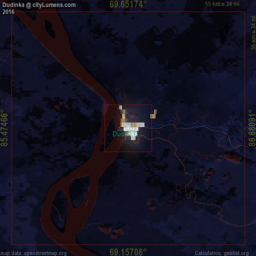
Analysis of Dudinka night lights 2016
Square area 10x10 km:
 4.45%
4.45%90-99
4.45%80-89
1.31%70-79
0.69%60-69
1.84%50-59
0.61%40-49
1%30-39
0.92%20-29
2.15%10-19
22.27%0-9
60.29%Square area 50x50 km:
0.17%90-99
0.17%80-89
0.06%70-79
0.03%60-69
0.1%50-59
0.04%40-49
0.04%30-39
0.05%20-29
0.08%10-19
0.88%0-9
98.39%Clear (daylight) street map image can be seen on geolist.org.
Map coordinates:
69° 39' 6.3" North, 85° 28' 28.8" East
69° 24' 21" North, 86° 10' 40" East
69° 9' 25.5" North, 86° 52' 51.3" East
Some cities around Dudinka sort by population:
• Norilsk
79.5 km =49.4 mi,  94°
94°
• Novyy Urengoy
544.8 km =338.5 mi,  227°
227°
• Talnakh
87.1 km =54.1 mi,  84°
84°
• Kayyerkan
61.4 km =38.2 mi, 92°
• Urengoy
504.2 km =313.3 mi,  220°
220°
• Igarka
216.4 km =134.5 mi,  175°
175°
• Korotchaevo
513.5 km =319.1 mi, 220°
• Tazovsky
372.7 km =231.6 mi, 234°
1507116 (p: 23,619)
Sources (retrieved 2019-11-25):
» Earth at Night: Flat Maps 2012, 2016