Borogontsy night lights from space
Night Light of Borogontsy (Sakha) from space (Russia) Src. Average luminocity for 10x10km area is 0.9127% and for 50x50km: 0.0364%.
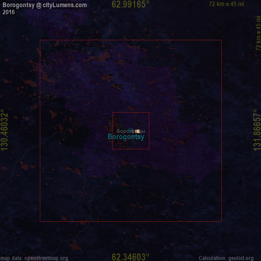
Analysis of Borogontsy night lights 2016
Square area 10x10 km:
 0%
0%90-99
0%80-89
0%70-79
0.5%60-69
0.3%50-59
0%40-49
0.4%30-39
0%20-29
0%10-19
0.4%0-9
98.41%Square area 50x50 km:
0%90-99
0%80-89
0%70-79
0.02%60-69
0.01%50-59
0%40-49
0.02%30-39
0%20-29
0%10-19
0.02%0-9
99.94%Clear (daylight) street map image can be seen on geolist.org.
Map coordinates:
62° 59' 29.9" North, 130° 27' 37.2" East
62° 40' 14.2" North, 131° 9' 48.4" East
62° 20' 45.7" North, 131° 51' 59.7" East
Some cities around Borogontsy sort by population:
• Yakutsk
102.3 km =63.6 mi,  226°
226°
• Markha
95.8 km =59.5 mi, 229°
• Pokrovsk
169.5 km =105.3 mi,  218°
218°
• Zhatay
89.2 km =55.4 mi, 230°
• Namtsy
76.5 km =47.5 mi,  274°
274°
• Churapcha
99.4 km =61.8 mi,  138°
138°
• Ytyk-Kyuyël’
127.7 km =79.3 mi,  105°
105°
• Mayya
113.3 km =70.4 mi,  203°
203°
2026160 (p: 5,280)
Sources (retrieved 2019-11-25):
» Earth at Night: Flat Maps 2012, 2016