Zhatay night lights from space
Night Light of Zhatay (Sakha) from space (Russia) Src. Average luminocity for 10x10km area is 19.0593% and for 50x50km: 6.3258%.
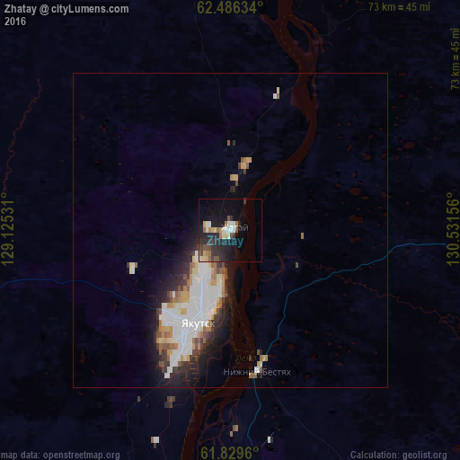
Analysis of Zhatay night lights 2016
Square area 10x10 km:
 1.88%
1.88%90-99
2.67%80-89
2.37%70-79
2.08%60-69
2.08%50-59
2.08%40-49
2.87%30-39
2.96%20-29
9.29%10-19
18.28%0-9
53.46%Square area 50x50 km:
1.76%90-99
1.34%80-89
0.51%70-79
0.67%60-69
0.56%50-59
0.61%40-49
0.53%30-39
0.75%20-29
1.57%10-19
3.1%0-9
88.57%Clear (daylight) street map image can be seen on geolist.org.
Map coordinates:
62° 29' 10.8" North, 129° 7' 31.1" East
62° 9' 35.1" North, 129° 49' 42.3" East
61° 49' 46.6" North, 130° 31' 53.6" East
Some cities around Zhatay sort by population:
• Yakutsk
14.8 km =9.2 mi,  199°
199°
• Markha
6.7 km =4.2 mi,  221°
221°
• Pokrovsk
84.1 km =52.3 mi,  205°
205°
• Namtsy
62.8 km =39 mi,  352°
352°
• Churapcha
136.8 km =85 mi,  97°
97°
• Mokhsogollokh
96.9 km =60.2 mi, 208°
• Mayya
52.5 km =32.6 mi,  153°
153°
• Borogontsy
89.2 km =55.4 mi,  50°
50°
2012570 (p: 8,131)
Sources (retrieved 2019-11-25):
» Earth at Night: Flat Maps 2012, 2016