Baymak night lights from space
Night Light of Baymak (Bashkortostan Republic) from space (Russia) Src. Average luminocity for 10x10km area is 1.8823% and for 50x50km: 1.1731%.
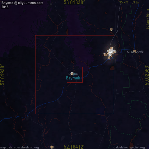
Analysis of Baymak night lights 2016
Square area 10x10 km:
 0.4%
0.4%90-99
0.66%80-89
0%70-79
0%60-69
0%50-59
0.53%40-49
0%30-39
0.53%20-29
0%10-19
1.06%0-9
96.83%Square area 50x50 km:
0.28%90-99
0.3%80-89
0.05%70-79
0.05%60-69
0.07%50-59
0.15%40-49
0.1%30-39
0.06%20-29
0.12%10-19
1.24%0-9
97.57%Clear (daylight) street map image can be seen on geolist.org.
Map coordinates:
53° 1' 6.2" North, 57° 37' 9.8" East
52° 35' 36" North, 58° 19' 21" East
52° 9' 50.8" North, 59° 1' 32.3" East
Some cities around Baymak sort by population:
• Magnitogorsk
103.8 km =64.5 mi,  27°
27°
• Sibay
27 km =16.8 mi,  59°
59°
• Gay
125.6 km =78 mi,  175°
175°
• Energetik
99.7 km =62 mi,  161°
161°
• Mrakovo
115.3 km =71.6 mi,  276°
276°
• Agapovka
95.3 km =59.2 mi, 34°
• Zilair
72.1 km =44.8 mi,  236°
236°
• Ak”yar
81.9 km =50.9 mi, 184°
578534 (p: 17,493)
Sources (retrieved 2019-11-25):
» Earth at Night: Flat Maps 2012, 2016