Balakirevo night lights from space
Night Light of Balakirevo (Vladimir) from space (Russia) Src. Average luminocity for 10x10km area is 0.3875% and for 50x50km: 1.2793%.
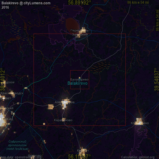
Analysis of Balakirevo night lights 2016
Square area 10x10 km:
 0%
0%90-99
0%80-89
0%70-79
0.45%60-69
0%50-59
0%40-49
0%30-39
0%20-29
0%10-19
0%0-9
99.55%Square area 50x50 km:
0.14%90-99
0.12%80-89
0.09%70-79
0.24%60-69
0.18%50-59
0.25%40-49
0.17%30-39
0.09%20-29
0.17%10-19
0.96%0-9
97.6%Clear (daylight) street map image can be seen on geolist.org.
Map coordinates:
56° 53' 30.9" North, 38° 8' 24.4" East
56° 30' 21.2" North, 38° 50' 35.7" East
56° 6' 57.1" North, 39° 32' 46.9" East
Some cities around Balakirevo sort by population:
• Aleksandrov
14.7 km =9.1 mi,  213°
213°
• Kol’chugino
40.4 km =25.1 mi,  124°
124°
• Pereslavl’-Zalesskiy
26 km =16.2 mi,  1°
1°
• Kirzhach
39.3 km =24.4 mi,  178°
178°
• Karabanovo
22.8 km =14.2 mi,  202°
202°
• Strunino
21.7 km =13.5 mi,  227°
227°
• Krasnozavodsk
39 km =24.2 mi,  260°
260°
• Bogorodskoye
40.5 km =25.2 mi,  269°
269°
579496 (p: 8,932)
Sources (retrieved 2019-11-25):
» Earth at Night: Flat Maps 2012, 2016