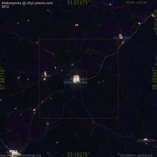
Alekseyevka night lights from space
Night Light of Alekseyevka (Belgorod Oblast) from space (Russia) Src. Average luminocity for 10x10km area is 10.9866% and for 50x50km: 0.5857%.
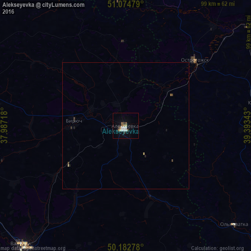
Analysis of Alekseyevka night lights 2016
Square area 10x10 km:
 2.41%
2.41%90-99
1.87%80-89
0.53%70-79
0.53%60-69
2.01%50-59
1.74%40-49
1.07%30-39
1.2%20-29
0.67%10-19
1.6%0-9
86.36%Square area 50x50 km:
0.1%90-99
0.08%80-89
0.06%70-79
0.03%60-69
0.1%50-59
0.08%40-49
0.13%30-39
0.08%20-29
0.08%10-19
0.13%0-9
99.16%Clear (daylight) street map image can be seen on geolist.org.
Map coordinates:
51° 4' 29.2" North, 37° 59' 13.8" East
50° 37' 51.2" North, 38° 41' 25.1" East
50° 10' 58" North, 39° 23' 36.3" East
Some cities around Alekseyevka sort by population:
• Rossosh’
55.9 km =34.7 mi,  347°
347°
• Valuyki
63 km =39.1 mi,  221°
221°
• Ostrogozhsk
37.7 km =23.4 mi,  45°
45°
• Novyy Oskol
60 km =37.3 mi,  284°
284°
• Volokonovka
61.2 km =38 mi,  254°
254°
• Kamenka
52.4 km =32.6 mi,  79°
79°
• Krasnogvardeyskoye
20.3 km =12.6 mi, 275°
• Veydelevka
55.9 km =34.7 mi,  197°
197°
582956 (p: 39,848)
Sources (retrieved 2019-11-25):
» Earth at Night: Flat Maps 2012, 2016