Zemun night lights from space
Night Light of Zemun (Central Serbia) from space (Serbia) Src. Average luminocity for 10x10km area is 84.6603% and for 50x50km: 34.9512%.
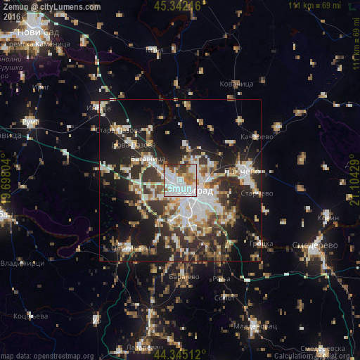
Analysis of Zemun night lights 2016
Square area 10x10 km:
 36.35%
90-99
28.89%80-89
2.86%70-79
4.44%60-69
10.16%50-59
6.83%40-49
4.76%30-39
5.56%20-29
0.16%10-19
0%0-9
0%Square area 50x50 km:
7.03%90-99
8.1%80-89
3.36%70-79
3.38%60-69
3.76%50-59
3.9%40-49
4.11%30-39
5.64%20-29
10.97%10-19
18.64%0-9
31.11%Clear (daylight) street map image can be seen on geolist.org.
Map coordinates:
45° 20' 31.8" North, 19° 41' 52.9" East
44° 50' 44.9" North, 20° 24' 4.2" East
44° 20' 42.4" North, 21° 6' 15.4" East
Some cities around Zemun sort by population:
• Belgrade
6.9 km =4.3 mi,  132°
132°
• Pančevo
19.2 km =11.9 mi,  81°
81°
• Sremčica
18.8 km =11.7 mi,  182°
182°
• Nova Pazova
18 km =11.2 mi,  307°
307°
• Surčin
11.2 km =7 mi,  238°
238°
• Dobanovci
14.1 km =8.8 mi,  261°
261°
• Umka
20.1 km =12.5 mi,  202°
202°
• Barič
24.4 km =15.2 mi,  207°
207°
783920 (p: 155,591)
Sources (retrieved 2019-11-25):
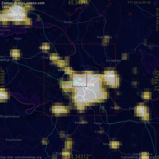
» NASA, Earths city lights 1995
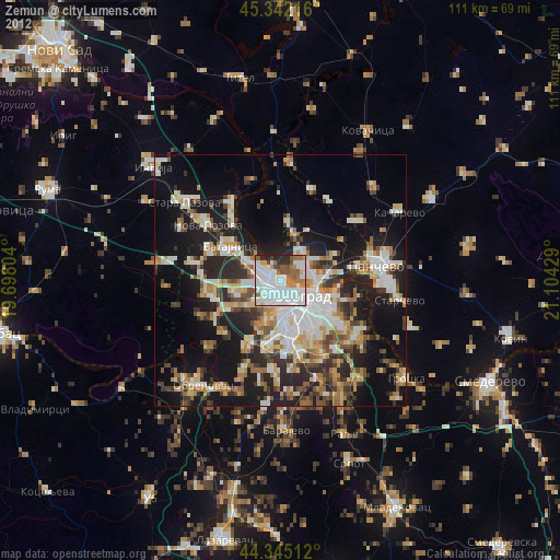
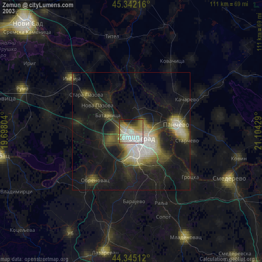
» NASA city lights 2003
» Earth at Night: Flat Maps 2012, 2016