Belgrade night lights from space
Night Light of Belgrade (Central Serbia) from space (Serbia) Src. Average luminocity for 10x10km area is 95.2444% and for 50x50km: 35.5836%.
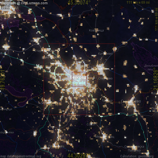

Analysis of Belgrade night lights 2016
Square area 10x10 km:
 54.6%
54.6%90-99
31.9%80-89
1.9%70-79
4.92%60-69
5.4%50-59
0%40-49
1.27%30-39
0%20-29
0%10-19
0%0-9
0%Square area 50x50 km:
6.92%90-99
7.91%80-89
3.36%70-79
3.59%60-69
3.87%50-59
4.24%40-49
4.27%30-39
5.93%20-29
11.53%10-19
18.72%0-9
29.64%Clear (daylight) street map image can be seen on geolist.org.
Map coordinates:
45° 18' 2.7" North, 19° 45' 43.2" East
44° 48' 14.4" North, 20° 27' 54.5" East
44° 18' 10.7" North, 21° 10' 5.7" East
Fantastic image of Belgrade from space taken by astronauts [src2], but I don't have information about it's orientation, scale or angle. If necessary, it was rotated manually, so North points approximately to upper direction. Click to zoom in:

Some cities around Belgrade sort by population:
• Zemun
6.9 km =4.3 mi,  312°
312°
• Pančevo
15.8 km =9.8 mi,  61°
61°
• Sremčica
15.3 km =9.5 mi,  202°
202°
• Nova Pazova
24.8 km =15.4 mi, 308°
• Surčin
14.6 km =9.1 mi,  265°
265°
• Dobanovci
19.1 km =11.9 mi,  277°
277°
• Umka
18.9 km =11.7 mi,  222°
222°
• Barič
23.6 km =14.7 mi, 223°
792680 (p: 1,273,651)
Sources (retrieved 2019-11-25):
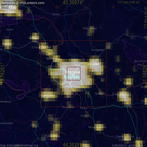
» NASA, Earths city lights 1995
» NASA city lights 2003
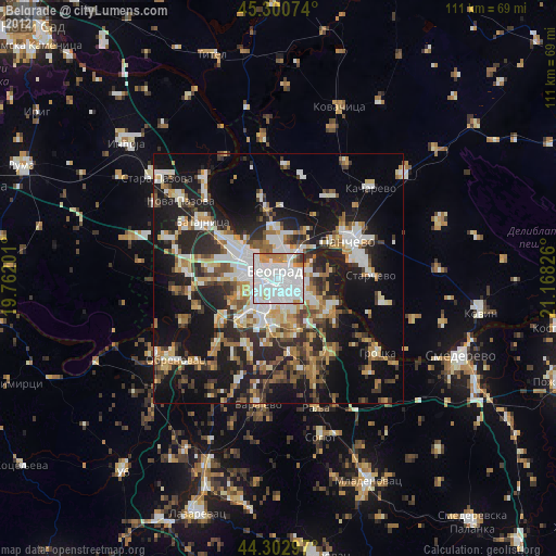
» Earth at Night: Flat Maps 2012, 2016
Src.2: Nasa night light images