Beška night lights from space
Night Light of Beška (Vojvodina) from space (Serbia) Src. Average luminocity for 10x10km area is 14.6045% and for 50x50km: 14.3734%.
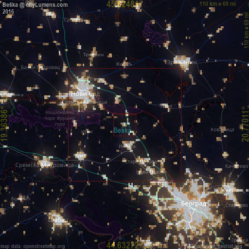
Analysis of Beška night lights 2016
Square area 10x10 km:
 1.82%
1.82%90-99
1.82%80-89
1.67%70-79
1.67%60-69
0.76%50-59
3.18%40-49
1.82%30-39
0.91%20-29
0.3%10-19
11.67%0-9
74.39%Square area 50x50 km:
2.27%90-99
2.89%80-89
1.27%70-79
1.26%60-69
1.29%50-59
1.73%40-49
1.33%30-39
1.8%20-29
4.2%10-19
11.99%0-9
69.97%Clear (daylight) street map image can be seen on geolist.org.
Map coordinates:
45° 37' 29.3" North, 19° 21' 49.9" East
45° 7' 51.3" North, 20° 4' 1.1" East
44° 37' 57.8" North, 20° 46' 12.4" East
Some cities around Beška sort by population:
• Novi Sad
22.5 km =14 mi,  306°
306°
• Ruma
23.6 km =14.7 mi,  234°
234°
• Inđija
9.3 km =5.8 mi,  172°
172°
• Stara Pazova
17.8 km =11.1 mi,  155°
155°
• Petrovaradin
19.5 km =12.1 mi, 311°
• Sremski Karlovci
13.2 km =8.2 mi, 307°
• Titel
19.7 km =12.2 mi,  64°
64°
• Kovilj
12 km =7.5 mi,  343°
343°
792651 (p: 6,377)
Sources (retrieved 2019-11-25):
» Earth at Night: Flat Maps 2012, 2016