Vărbilău night lights from space
Night Light of Vărbilău (Prahova) from space (Romania) Src. Average luminocity for 10x10km area is 0.253% and for 50x50km: 4.1592%.
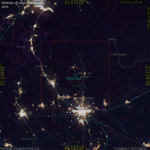
Analysis of Vărbilău night lights 2016
Square area 10x10 km:
 0%
0%90-99
0%80-89
0%70-79
0%60-69
0%50-59
0.3%40-49
0%30-39
0%20-29
0%10-19
0%0-9
99.7%Square area 50x50 km:
0.35%90-99
0.4%80-89
0.14%70-79
0.22%60-69
0.65%50-59
0.82%40-49
1.26%30-39
0.99%20-29
1.67%10-19
2.43%0-9
91.08%Clear (daylight) street map image can be seen on geolist.org.
Map coordinates:
45° 40' 36.3" North, 25° 14' 48.8" East
45° 10' 60" North, 25° 57' 0" East
44° 41' 8.1" North, 26° 39' 11.3" East
Some cities around Vărbilău sort by population:
• Vălenii de Munte
6.5 km =4 mi,  90°
90°
• Brebu Mânăstirei
14.4 km =8.9 mi,  270°
270°
• Slănic
7.5 km =4.7 mi,  350°
350°
• Doftana
12.3 km =7.6 mi,  252°
252°
• Telega
14.2 km =8.8 mi, 246°
• Scorţeni
12.1 km =7.5 mi,  220°
220°
• Gura Viţioarei
7.5 km =4.7 mi,  119°
119°
• Drajna de Jos
8.7 km =5.4 mi,  64°
64°
663178 (p: 7,084)
Sources (retrieved 2019-11-25):
» Earth at Night: Flat Maps 2012, 2016