Sânpetru Mare night lights from space
Night Light of Sânpetru Mare (Timiş) from space (Romania) Src. Average luminocity for 10x10km area is 2.2017% and for 50x50km: 2.4544%.
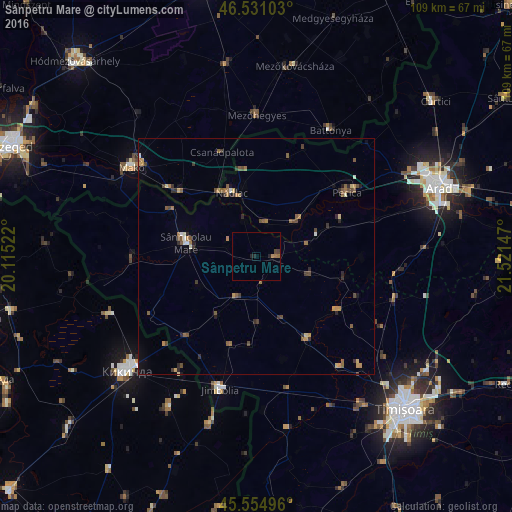
Analysis of Sânpetru Mare night lights 2016
Square area 10x10 km:
 0%
0%90-99
0%80-89
0%70-79
0.57%60-69
0.71%50-59
0.43%40-49
0.71%30-39
0.43%20-29
1.7%10-19
0%0-9
95.45%Square area 50x50 km:
0.08%90-99
0.17%80-89
0.2%70-79
0.37%60-69
0.54%50-59
0.59%40-49
0.56%30-39
0.48%20-29
0.52%10-19
0.37%0-9
96.12%Clear (daylight) street map image can be seen on geolist.org.
Map coordinates:
46° 31' 51.7" North, 20° 6' 54.8" East
46° 2' 42.5" North, 20° 49' 6" East
45° 33' 17.9" North, 21° 31' 17.3" East
Some cities around Sânpetru Mare sort by population:
• Sânnicolau Mare
14.9 km =9.3 mi,  286°
286°
• Lovrin
9.3 km =5.8 mi,  203°
203°
• Nădlac
14.5 km =9 mi,  338°
338°
• Periam
3.8 km =2.4 mi,  81°
81°
• Biled
20.7 km =12.9 mi,  148°
148°
• Variaş
10.6 km =6.6 mi,  107°
107°
• Secusigiu
13.4 km =8.3 mi,  71°
71°
• Lenauheim
19.3 km =12 mi,  184°
184°
666950 (p: 5,782)
Sources (retrieved 2019-11-25):
» Earth at Night: Flat Maps 2012, 2016