Vadu Moldovei night lights from space
Night Light of Vadu Moldovei (Suceava) from space (Romania) Src. Average luminocity for 10x10km area is 0.0432% and for 50x50km: 0.3828%.
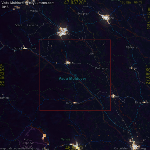
Analysis of Vadu Moldovei night lights 2016
Square area 10x10 km:
 0%
0%90-99
0%80-89
0%70-79
0%60-69
0%50-59
0%40-49
0%30-39
0%20-29
0%10-19
0%0-9
100%Square area 50x50 km:
0.02%90-99
0.03%80-89
0.03%70-79
0.06%60-69
0.05%50-59
0.07%40-49
0.1%30-39
0.06%20-29
0.11%10-19
0.14%0-9
99.34%Clear (daylight) street map image can be seen on geolist.org.
Map coordinates:
47° 51' 26.1" North, 25° 39' 48.8" East
47° 22' 60" North, 26° 22' 0" East
46° 54' 18.4" North, 27° 4' 11.3" East
Some cities around Vadu Moldovei sort by population:
• Fălticeni
9 km =5.6 mi,  325°
325°
• Dolhasca
18.4 km =11.4 mi,  72°
72°
• Preuteşti
8.3 km =5.2 mi,  26°
26°
• Răuceşti
15.3 km =9.5 mi,  165°
165°
• Cornu Luncii
18.7 km =11.6 mi,  299°
299°
• Baia
11.9 km =7.4 mi,  288°
288°
• Tătăruşi
18 km =11.2 mi,  101°
101°
• Brusturi
11.2 km =7 mi, 173°
664003 (p: 7,325)
Sources (retrieved 2019-11-25):
» Earth at Night: Flat Maps 2012, 2016