Ianca night lights from space
Night Light of Ianca (Brăila) from space (Romania) Src. Average luminocity for 10x10km area is 1.9273% and for 50x50km: 0.5326%.
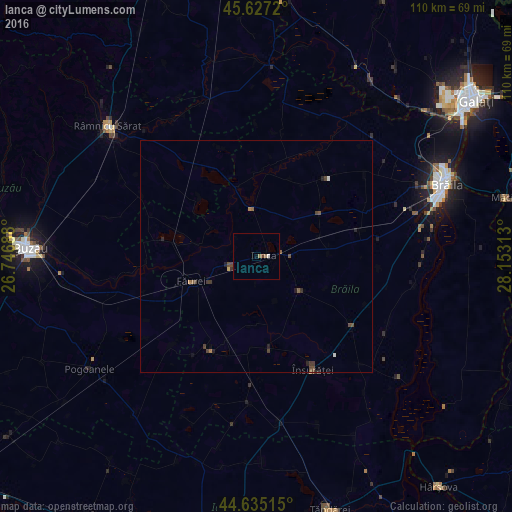
Analysis of Ianca night lights 2016
Square area 10x10 km:
 0%
0%90-99
0.61%80-89
0%70-79
0%60-69
1.21%50-59
0%40-49
0.61%30-39
0%20-29
0%10-19
0%0-9
97.58%Square area 50x50 km:
0.01%90-99
0.06%80-89
0.02%70-79
0.01%60-69
0.12%50-59
0.17%40-49
0.26%30-39
0.16%20-29
0.16%10-19
0.1%0-9
98.93%Clear (daylight) street map image can be seen on geolist.org.
Map coordinates:
45° 37' 37.9" North, 26° 44' 48.8" East
45° 7' 60" North, 27° 27' 0" East
44° 38' 6.5" North, 28° 9' 11.3" East
Some cities around Ianca sort by population:
• Însurăţei
26.8 km =16.7 mi,  153°
153°
• Viziru
23.5 km =14.6 mi,  123°
123°
• Tufeşti
30.2 km =18.8 mi,  107°
107°
• Cochirleanca
33.9 km =21.1 mi,  285°
285°
• Săgeata
36.8 km =22.9 mi,  264°
264°
• Tudor Vladimirescu
29 km =18 mi,  71°
71°
• Măicăneşti
41 km =25.5 mi,  5°
5°
• Chiscani
38.3 km =23.8 mi,  81°
81°
675840 (p: 11,209)
Sources (retrieved 2019-11-25):
» Earth at Night: Flat Maps 2012, 2016